With ten provinces and three territories, Canada is the second-largest country in the world. The southernmost province Ontario acquired its name from the Indigenous Iroquois word “kanadario”, which translates into “sparkling water”. With five Great Lakes nearby and about 250,000 freshwater lakes, it’s no wonder!
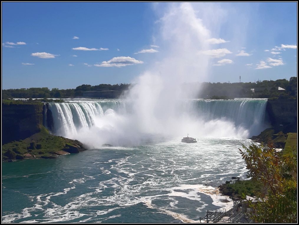
Ontario’s landscape features diverse elevations and varied topography, influenced by its geological history. The province is characterized by the vast, rocky Canadian Shield, which separates the fertile southern farmlands from the northern lowlands with boreal forests and tundra.
Generally, the entire province of Ontario has a low elevation, averaging 245 metres (800 ft). The lowest elevation is the sea level (no land surface is below the sea level), especially at the shores of Hudson Bay and at the mouth of the St. Lawrence River where it empties into the Atlantic Ocean – it is literally the sea level! Lake Ontario also sits at a low elevation of about 74 meters (240 ft) above sea level. Ishpatina Ridge (about 600 km north of Toronto) is the highest point in Ontario, at an estimated elevation of 693 m (2,274 ft) above sea level. Not much, huh?
Although there are no truly high elevations or mountains in Ontario, the rocky Canadian Shield, which runs through the province from northwest to southeast, and the Niagara Escarpment which crosses the south, are two major landscape features of the province. When lakes and especially rivers cut through, beautiful canyons and waterfalls are created. Today we’ll focus on the canyons, these are our favourites:
Ouimet Canyon
The largest canyon in Ontario is Ouimet Canyon and is located about one hour drive northeast of Thunder Bay. It is 100 m deep and 150 m wide and is known for its steep cliffs, massive slabs and a unique microclimate at the bottom of the canyon that supports arctic-alpine plants.
A short and easy trail and boardwalk totaling 1.1 km connects two lookout points, where you can admire the expanse of the canyon and can read more about the flora that exists at the bottom of the canyon. It is said that the bottom of the canyon hosts plants that actually grow on the shores of Hudson Bay, 1,000 km to the north.
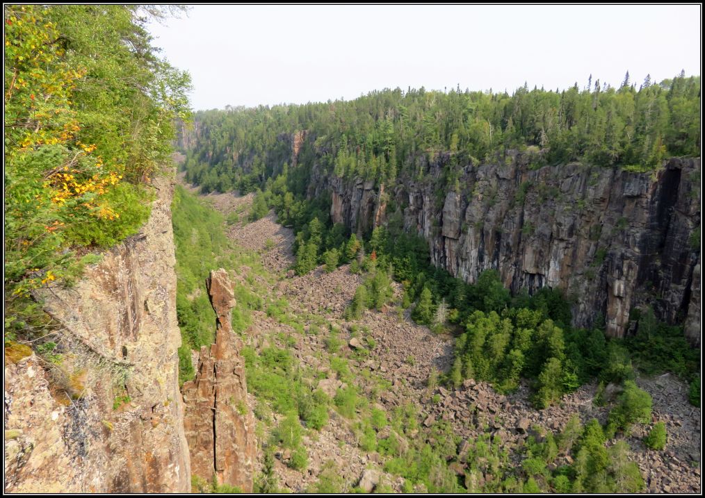
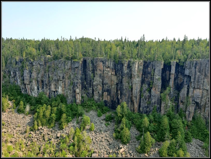
The wide and deep canyon, flanked by ancient dark-coloured rocks is topped by a green layer of pine trees making a view hard to forget. The canyon is believed to have formed when the subvolcanic rocks, dating back a billion years, were split open by the weight of advancing glaciers or by the volumes of water released during their retreat.
***
Eagle canyon
Near Ouimet Canyon is the privately owned and operated Eagle Canyon. Sometimes overlooked, Eagle Canyon is most famous for its two footbridges spanning the gorge.
There is about 0.5 hr hike to the first suspension bridge if you prefer walking, or you can ask for a free shuttle service available from the visitor centre.
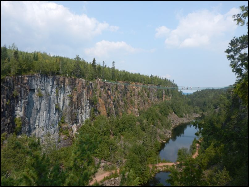
The longer footbridge is 600 feet long and is suspended 152 feet above the canyon floor. If one bridge is not enough for you, the smaller bridge which spans 300 feet and hangs 125 feet above the canyon floor might give you more thrill. I’m definitely not a fan of heights, not even when kids go and jump around, but if you are in no rush, you can certainly find a good time to cross them at your leisure, as the place is not busy at all.

***
Niagara Gorge
Niagara Gorge is the best-known canyon in Ontario and perhaps in all of Canada. It begins at the base of Niagara Falls and it ends 11 km downstream near the town of Queenston, where the famous falls originated some 14,000 years ago.
Niagara River (with a length of 55 km) begins from Lake Erie and flows over Niagara Falls to Lake Ontario. There are several spots where you can stop and see Niagara Gorge from above. You can try ziplining or take the historic Whirlpool Aero Car and ride over the vibrant and tumultuous waters of the Niagara River. You can stop along the Niagara River Pkway which runs along the river itself, or discover some of nature’s most beautiful and mysterious creations at Niagara Glen.
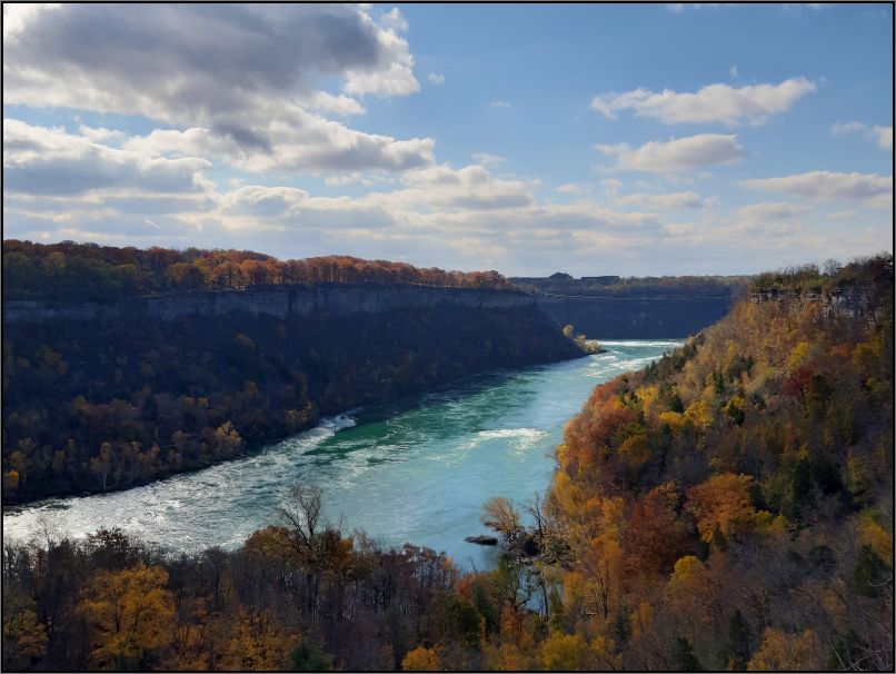
Located at the bottom of the Niagara Gorge, after descending several steps, Niagara Glen is home to several rugged hiking paths winding through a pristine patch of Carolinian forest and prehistoric geological formations. As Niagara Falls has retracted for the past 10,000 years, erosion created unique landscapes, leaving behind sheer cliffs overlooking the river. The trails in Niagara Glen follow the river all the way to the Niagara Whirlpool, the most famous rushing waters after the falls themselves.

***
Elora Gorge
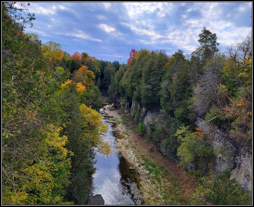
Nestled in the heart of the Grand River Valley, just outside the historic town of Elora, lies Elora Gorge. This spectacular natural area features 22-metre-high limestone cliffs that flank the roaring Grand River.
Elora Gorge is about 1.5 hrs west of Toronto and is probably the most known gorge in Ontario, after Niagara.
Victoria Park in Elora offers free parking for those who want to explore the hiking trails along the river, and there are a few lookout points from which you can admire the gorge. If you enjoy outdoor activities and want to explore more, then the Elora Gorge Conservation area offers you hiking trails, scenic lookouts, as well as camping, fishing and picnicking opportunities. Another major draw is the chance to go tubing or kayaking through the rapids or calm waters of the river.
***
Barron Canyon
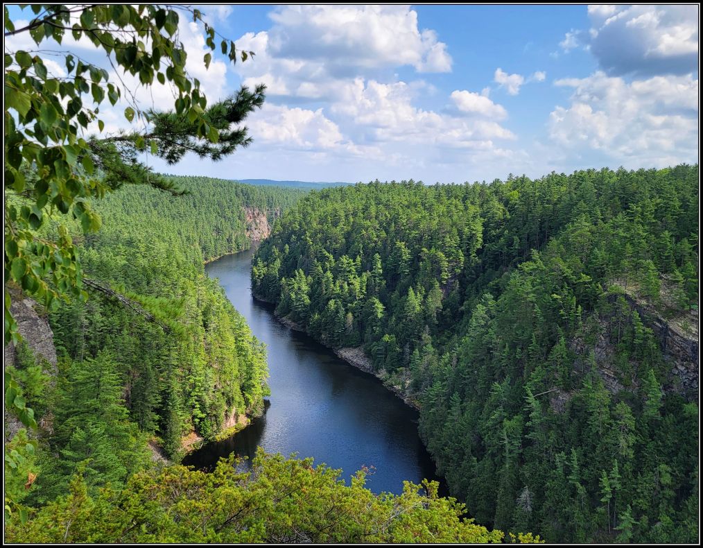
Barron Canyon is located within Algonquin Provincial Park, 11 km west of Sand Lake Gate, the easternmost gate of the park. A 1.5 km trail leads from the parking lot to the north rim of the 100-metres deep, Barron Cayon. Carved by the Barron River through rugged expanses of the Canadian Shield, on its way to the Petawawa and Saint Lawrence Rivers, the canyon follows the Ottawa-Bonnechere Graben, a 55km wide geological rift valley, formed some 450 million years ago by the shifting of the Earth’s crust. This extensive depression today extends between Lake Nipissing and Montreal.
The Barron Canyon itself, carved by glacial meltwater, is the primary highlight of the region. Towering 100 metre granite cliffs rise dramatically out of the river; their walls are coated in a peculiar colour of rusty orange, largely due to the presence of Xanthoria lichen that clings to the rocks of the canyon. Along the edge of the river, large mounds of talus, reminiscent of the mountains of the west, have accumulated along the canyon due to thousands of years of erosion.
The canyon and its surrounding forests are studded with a large assortment of pine trees as well as deciduous. Deep in the canyon, as a legacy of its cold glacial past, one can find rare and regionally unique, arctic and sub-arctic plants, such as the White Mountain Saxifrage.
***
Aguasabon gorge
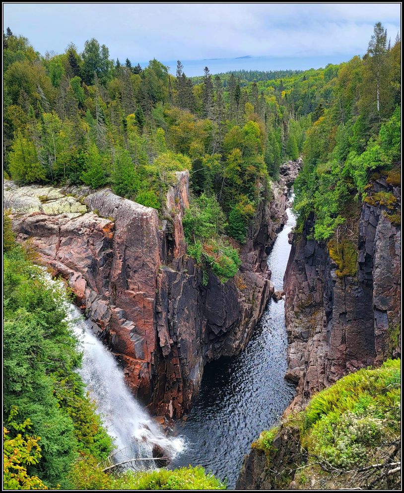
Aguasabon Falls and Gorge is a must-see attraction if you are in Terrace Bay, along the north shore of Lake Superior. A short walk from the parking lot located 1 km west of Terrace Bay leads you to an observation deck right above the falls.
The Aguasaon River looked very different a hundred years ago. In 1939, the quiet Aguasabon stream became a rushing river when the north end of Long Lake was dammed. As a result, the water changed its regular course and, instead of flowing northward to James Bay via the Kenogami River, it changed direction, flowing southward into Lake Superior. This actually raised the water level of Lake Superior and the other Great Lakes.
The beautiful waterfalls that cut forcefully into the rocky canyon offer visitors a refreshing mist and view.
The landscape was shaped by glaciers about 10,000 years ago also, but the geology of the entire area, including the Aguasabon Falls and Gorge dates back to 2.5 billion years ago. Hearing the roar of the 30-meter (100 ft) waterfalls and watching the water tumbling over the ancient cliffs is something you will never forget.
***
Agawa canyon
Three hours north of Sault Ste Marie is Agawa Canyon, in Algoma District. It was formed over 1 million years ago, reshaped by the last ice age and widened by the erosive action of Agawa River.
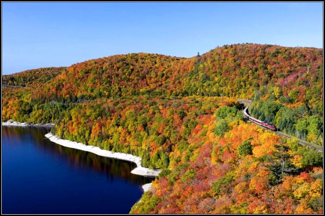
For years I thought the only way to get to the canyon was by train, as many rave about the Agawa Canyon Train Tour departing from Sault Ste. Marie. It is a 10-hour long day-trip, where passengers are able to explore the park and see few waterfalls cascading into the canyon once they reach the park. This tour is most popular in the autumn during the fall colours, so it’s a good idea to book the trip in advance.
It wasn’t until last year that I discovered that hiking is another way to get to this beautiful canyon. Towab Trail is not very popular due to the distance and effort, but it was interesting to find out that there is another way to see and enjoy the nature, as the trail travels along the Agawa River, culminating to the 25 m high Agawa Falls. But not many people would be willing to hike this difficult 24-km long trail! The best option to see the canyon is definitely by train: the large windows will allow you to enjoy the beauty of the magical forests, sparking rivers and incredible rock formations that the Canadian Shield is famous for, while sitting in the comfortable couches.
***
French River Gorge
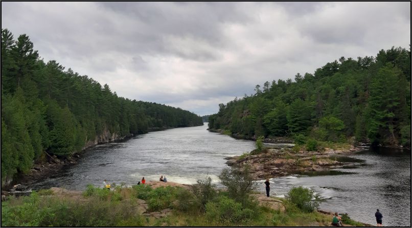
A river of national historical significance, the French River is the first designated Canadian Heritage River. A paddling route for Indigenous people, French Explorers, fur traders and Voyageurs, this 105-km river connects Lake Nipissing to Georgian Bay. The most accessible and scenic point of the gorge is along Hwy 69 – TransCanada 1, at the William E. Small bridge.
Located within French River Provincial Park, William E Small Bridge is said to be the largest snowmobile bridge of its kind in the world, built by the Voyageurs snowmobile club in 2005. It can carry a large heavy trail grooming machine or over 100 snowmobiles at a time.

Historically, French River served as a vital waterway for Indigenous People and later became a key route for French explorers and fur traders in the 17th century. Today, the river is used for recreational purposes, as several interconnected canoe routes link nearby rivers.
A 3 km trail starts at the Visitor Centre, following the edge of the French River Gorge, and ends at the historic Recollet Falls.
***
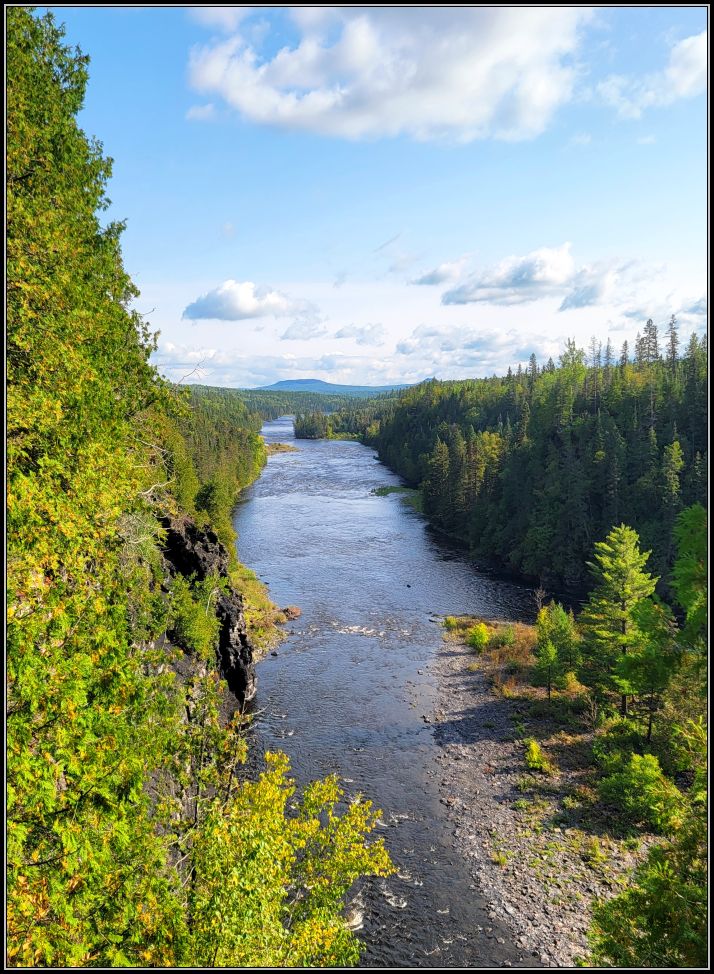
Kaministiquia River gorge
Famous for Kakabeka Falls and Fort William, Kaministiquia River has been a major waterway since ancient times, but especially since the river was part of the voyageur route in the 18th-19th centuries, when the French transported furs by canoe during the height of the North American fur trade.
At 40 m (130 ft) high, cascading over a high cliff, Kakabeka Falls is probably the second largest waterfall in Ontario, but it is certainty the largest waterfall in the northwest of the province. Because of its size, it has been nicknamed “Niagara of the North”.
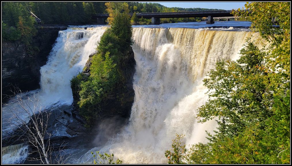
The rock face of the falls and the escarpments continue to carve out every year, as the power of the waterfalls continue to erode the unstable shale, creating the gorge. Due to the fragile rocks and ecosystem, entry into the gorge below the falls is prohibited.
***
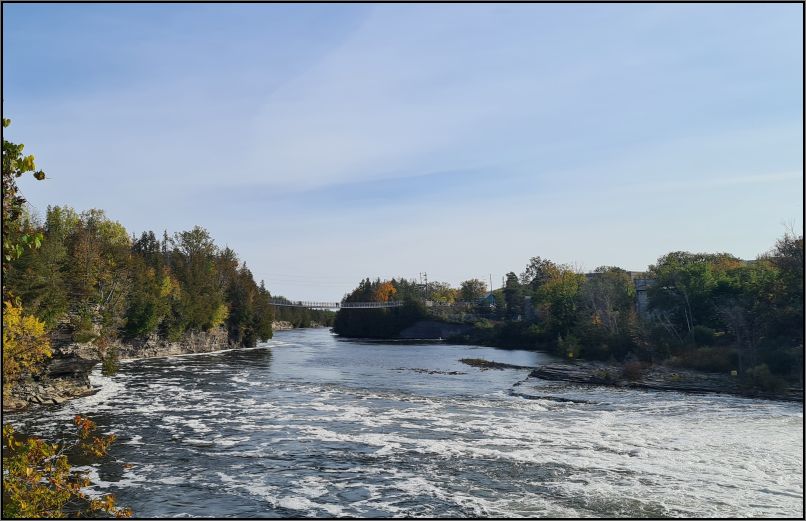
Ranney Gorge
Ranney Falls, a nature site located in Campbellford, Ontario, is a popular place to visit because of the suspension bridge that crosses the Trent River. Part of the Trans-Canada Trail, the longest trail network in the world, the 300-feet Ranney Gorge suspension bridge offers a nice panoramic view of the river.
If you wish to further explore the area, you can visit the nearby Ferris Provincial Park, stop at any of the several locks on the Trent-Severn Waterway which links Lake Ontario at Trenton to Georgian Bay, Lake Huron at Port Severn. You can stop by The Giant Toonie (a Loonie is the Canadian 1-dollar coin and a Toonie is the Canadian 2-dollar coin) for some interesting roadside attractions, or you can easily stroll into downtown Campbellford for a bite to eat or some shopping.
***
p.s. The definitions of a canyon and a gorge are close enough that they can get mistaken one for another, sometimes. According to many dictionaries, a canyon is a deep, narrow valley with steep sides and often with a stream flowing through it, while a gorge is often the smaller version of a canyon, both words being used to describe deep, narrow valleys, with a stream or river flowing along their bottom. However, whether they are one or the other, they are both similar in shape and appearance.


Stunning list! I was in Niagra in 2024 and still to publish my draft. ☺️
LikeLiked by 1 person
That is a beautiful area, especially in the fall🥰
LikeLiked by 1 person
Fabulous! You’ll have to come along and be my tour guide, Christie. After your Camino, of course! Good luck and enjoy xx
LikeLiked by 1 person
Hehe, we did the Caminito del Rey last month.. OMG when the time passed..
Happy Wednesday! xx
LikeLiked by 1 person
Pardon the pun, Christie, but these places are just gorge-eous. Have a great Tuesday. lalan
LikeLiked by 2 people
Right?!😍 Have a beautiful week ahead, Allan!
LikeLike
Niagara is famous, that’s for sure, but the other canyons and gorges in Canada are just as stunning! I’ve only been to Canada a handful of times, and I’ll need to return to check these places out! Thanks for sharing 🙂
LikeLiked by 1 person
So many beautiful places waiting to be explored😊
Have a lovely day, xoxo
LikeLiked by 1 person
Well, those canyons would certainly challenge my dislike of heights, though I would happily ignore that dislike to experience some of the lesser known ones.
LikeLiked by 1 person
Hi Suzanne, as a person afraid of heights I can totally resonate with you😊 The only place I was that nervous was when we crossed the suspension bridges at Eagle Canyon. The rest can be seen from a decent distance.
xx
LikeLiked by 1 person
What a splendid choice!
LikeLiked by 1 person
Thank you!! xx
LikeLiked by 1 person
I didn’t realize there were so many canyons and gorges in Ontario. We’ve actually been to most of them on your list, except for Eagle Canyon and Agawa Canyon. We’re actually planning to take the Agawa Canyon Train Tour later this fall.
LikeLiked by 1 person
We were about to take the train tour last fall, but the ride is quite long, not really to our taste. I have the Towab trail on my list instead for the next time we are in that area.
LikeLiked by 1 person
What a great way to show Ontario’s natural beauty. Ive been to a few and even paddled on French, but still much more to see. Maggie
LikeLiked by 2 people
Not a bad idea, we have to check out their canoe routes, one day😊
LikeLike
Beautiful collection!!
LikeLiked by 1 person
Thank you! xx
LikeLike
Beautiful! I definitely need to plan a trip to these waterfalls and canyons. The only one I’ve visited is Niagara.
LikeLiked by 1 person
So many beautiful places around the world❤️
LikeLiked by 1 person
Wow, this is such a wonderful collection, dear Christie, and I am excited to learn all about the beautiful and spectacular canyons and gorges in Ontario. Thanks for sharing, and have a good day 🙂 Aiva xx
LikeLiked by 2 people
Have an amazing weekend! xoxo
LikeLiked by 1 person
Thank you 😊 xx
LikeLiked by 1 person