
Around Huron Lake in 8 days: Sault Ste Marie vs St Marys River
Pursuing our road trip around Huron Lake after leaving Manitoulin Island, our next destination was Sault Ste Marie. Passing cities like Espanola, and Spanish, or reservations such as Mississauga First Nation, I couldn’t stop noticing the French hint of Sault Ste Marie’s name. Anyone can sense from the distance how rich in history this whole area is, isn’t it? But more intriguingly, between the French name of Sault Ste Marie, and the English name for St Mary’s Rivers, I couldn’t stop asking myself which one came actually first?
According to http://www.thecanadianencyclopedia.ca/en/article/st-marys-river-ont/:
St Marys River (Ont) connects Lake Superior to Lake Huron and forms part of the US/Canada border. It is 125 km long and drops 6.4 m through the sault (old French term meaning “rapids” or “falls”), which gives the Canadian and US cities of Sault Ste Marie their names. The rapids offered prime habitat for fish, particularly whitefish, which the Ojibwa caught in nets from their birchbark canoes.
The obvious strategic value of the river was well known to the Indigenous people before Étienne Brûlé travelled the river in 1622. Samuel de Champlain included the falls on his 1632 map. The Jesuit mission of Sainte Marie du Sault was founded on the river in 1668 but was abandoned in 1698 because of the Iroquois Wars, as was the first of 2 French fur-trade posts, which was established in 1689. The North West Company arrived in 1783 and in 1798 built the first canal around the rapids. The canal was destroyed by American troops during the War of 1812.
Today there are 4 locks on the American side, operated by the US Corps of Engineers, and a smaller lock on the Canadian side, part of the Sault Ste Marie Canal National Historic Site. The locks and the river make up one of the busiest canal systems in the world, despite being frozen for up to 5 months of the year. The International Bridge (1963) spans the river, connecting the twin cities of Sault Ste Marie. The river was designated as a Canadian Heritage River in 2000.
Important junction to the Upper Great Lakes, St Mary’s River was and is still a landmark in this area.


After the visit of Etienne Brule in 1623, the French called this area “Sault de Gaston” in honour of Gaston, Duke of Orleans (the brother of King Louis XIII of France). In 1668, French Jesuit missionaries renamed it as Sault Sainte Marie (also known as the Sault or the Soo), and established a mission settlement on the south bank of the river.
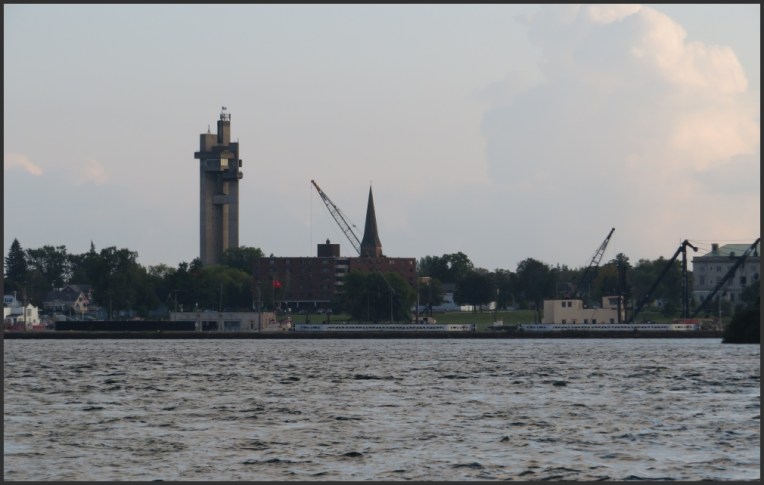
On the south, across the river, is the United States and the city of Sault Ste Marie, Michigan. These two communities were one city until a new treaty was signed after the War of 1812, and when St Mary’s River became the border between Canada and the United States in this area.

In 1870, the United States refused to give the steamer Chicona (which was carrying a colonel), permission to pass through the locks at Sault Ste Marie, hence the Canadians constructed the Sault Ste Marie Canal (completed in 1895) in order to have their own water passage.


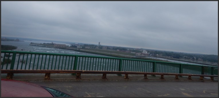
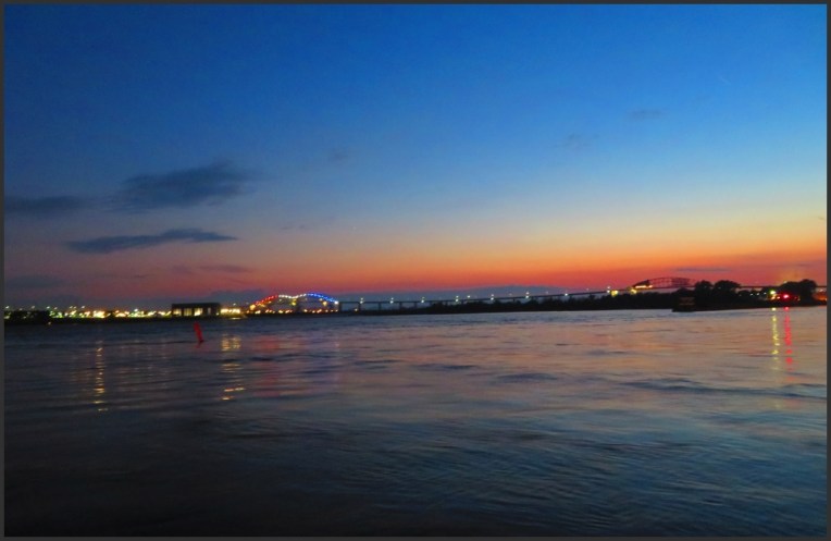
If you don’t know what to do if you have a couple of hours in Sault Ste Marie, the best option is to take a stroll on the waterfront boardwalk, especially if that is in the evening.


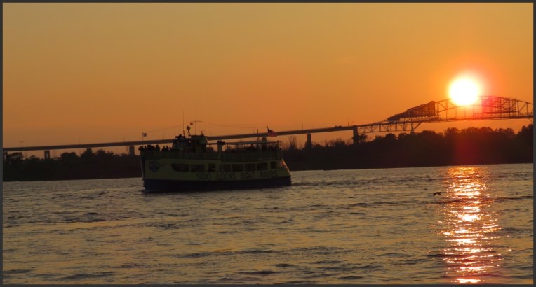
But if you have more than a few hours, then a cruise to visit Soo Locks will be much more interesting, you will be able to see all the locks, St Mary’s rapids, and the hydro-electric plants.
The Sault Ste. Marie International Bridge spans the St Mary’s River between the United States and Canada and connects the twin cities of Sault Ste Marie, Michigan and Sault Ste Marie, Ontario. This is a steel truss arch bridge with suspended deck. There are two separate spans, a double arch span on the U.S. side (crossing the four U.S. Soo Locks) and a single arch span crossing the Canadian side and lock.

It looks like they have those insane cruise ships there, too!
LikeLiked by 1 person
Haha not in Canada!! I was sorry we couldn’t stay longer, I would have liked to go on this cruise. Unfortunately we had only the evening, but the sunset beyond the bridge made my day!
LikeLike