
Canadians love outdoors. At least half of them, who can’t wait to get their outdoor belongings every weekend and scatter to various destinations.
Our excitement actually started when we began making plans to have a road trip around Lake Huron, one of the five Great Lakes in North America.

Part of the UNESCO heritage, Niagara Escarpment goes through Tobermory. The escarpment that runs from New York through Ontario (Canada), Michigan, Wisconsin and Illinois is mostly famous for the cliff where Niagara River plunges at Niagara Falls. But today I will talk about Tobermory, located right between Huron Lake and Georgian Bay, and which is the most northerly town in the Bruce Peninsula.
After four hours driving from Toronto on a Saturday morning, we happily arrived in this small, rustic and charming town, our first stop in our adventure. Tobermory is home for two major parks: Fathom Five National Marine Park and Bruce Peninsula National Park that offers clean air, clear waters, rugged cliffs, and any kind of activity that one can name it. The whole area offered us trails to hike, clear waters to see shipwrecks, a spectacular show for our eyes and heart.


One small section of the Bruce Peninsula NP is located on the Lake Huron shore, but the rest of the park is actually on the Eastern side of the peninsula, where most of the stunning landscape is. The famous Grotto and few nice trails are the most common features; even though one can do anything can think of, including scuba diving, biking, sailing, or kayaking. We hiked the trail to the Grotto, and then on the way back we walked on the boulders. The most I have enjoyed was the colour of the crystal waters. This kind of turquoise reminded me of Peyto Lake in Alberta, and the Caribbean beaches in Cuba.


If you want to visit Fanthom Five National Marine Park, then Flowerpot Island is the place you want to go. You can select a cruise during the day, but make sure you book your ticket in advance if you plan to go on the summer months!! When we visited Tobermory several years ago, we left disappointed since we couldn’t find any ticket available for the daily cruise. This time we ensured we had our tickets way before summer season started, so we don’t have regrets anymore. The tour took us firstly in the Big Tub Harbour, where crystal clear waters let us see so close 2 of the 20 shipwrecks in the area. We sit on the upper level of the ship, where we had an awesome view of the waters and surroundings. We could see lots of kayakers going around in search for adventures, and also some divers.


We only had time for one trail on the Flowerpot Island, but we took our time to enjoy our snacks sitting on the rocks at the end of the island. I could simply sit there and watch the waves, the seagulls, and the butterflies for a long time. I could daydream for hours if time was not for our return.
Tobermory is one of the most beautiful destinations I visited in Ontario, if you would like to find or see more, you can read here.
After 2 sunny days in Tobermory we continued our journey to Manitoulin Island.

Chi-Cheemaun (or Big Canoe in Obijwa language) is the name of the ferry that took us from Bruce Peninsula to South Baymouth on Manitoulin Island. Pristine lands, green pastures, our third day of our trip was used to learn a little bit about Canadian and local history.

Home to three distinct cultures – First Nations, Francophone and Anglophone – this region has a diverse culture and a rich history. The island itself is considered sacred by the Native Anishinaabe people, who identify themselves as the “People of the Three Fires”. Manitoulin Island is considered by natives The Heart and Spirit of the Great Lakes of Canada. Moreover, Wikwemikong is an unceded Indian Reserve in Canada, which means that it has not “relinquished title to its land to the government by any treaty or otherwise.”


We had a great experience on the cruise, and we greatly appreciated our chance to learn more about the Spirit Island (translation of Manitoulin in Ojibwe language).
Leaving Manitoulin Island by the Little Current Swing Bridge,


we continued our road trip on the fourth day up North on Hwy 6. The road passes by Whitefish falls which was a stop on our list. We could see the signs of the town, but we couldn’t find absolutely no indication where the falls are located. We had no other way than driving randomly around the few streets of this small town, until, suddenly, we were surprised by a nice view of the falls right from the Main Street, across the river.

Passing by cities like Espanola, and Spanish, or reservations such as Mississauga First Nation, the road is winding up West towards St Sault Marie.
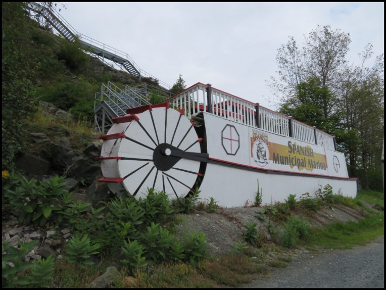
The Town of Spanish, located on the TransCanada Hwy, between Sudbury and Sault Ste. Marie, is situated at the mouth of the Spanish River where it empties into the North Channel of Lake Huron. This river and its ecologically rich delta had a positive impact on the development of the community of Spanish, used in the past for fur trade, or to carry the timber down to Georgian Bay. Now the river is mainly used for recreational canoeing. Numerous people have attempted to explain the name “Spanish” in what was once historically part of New France, and there are several different theories regarding the name of the community.
There are four hydroelectric dams on the river: the one we could see right from the street is Domtar mill in Espanola. Espanola was another surprise for us, interesting to find such names in an area dominated by natives, Anglophones and francophone. The story of the name is that a First Nation Ojibwa tribe brought back from the south a white woman who spoke Spanish, and who married a local First Nation Anishinabek. Later, it was found that many local natives spoke broken Spanish, which had been late anglicized to “Espanola”, while the river was named Spanish River.

Our fourth day ended with a nice stroll in Sault Ste Marie – in Canada. After driving about 350 km from Manitoulin Island, the boardwalk along the river offered us a peaceful evening and a superb sunset. We learned more about the rapids on the river and about the Sault Ste Marie sister, which was right in front of us, on the American side of the river. Time and events split many areas that should still be together; in this case a river.


One’s destination is never a place, but always a new way of seeing things. – Henry Miller
In our case was the road to Tahquamenon Falls that happened to pass through Paradise. It was meant for us to take this road. The day was bright despite the rainy morning. It was our fifth day, when we crossed the border South to US.

The centerpiece of Tahquamenon Falls State Park is Tahquamenon River with its 2 major falls. The origin of the name Tahquamenon is attributed to the water’s amber colour. And if the colour makes you think of amber ale, then yes, this is what we thought of when we saw this beautiful river in that bright summer day. We climbed both boardwalks to see the falls from a better perspective, enjoying the fresh-after rain air.


Going to Munising on M-28, we couldn’t avoid Seney. Beckoning signs, wildlife lovers, we had to have a stop at Seney National Wildlife Refuge. If going in the middle of the day didn’t reward us with many birds, we took our time to enjoy the sights, the quietness, and the clear skies.


The following 3 days were booked for Pictured Rocks National Park. The enchanting forests and the great Superior Lake offered us more than we expected. The Southern side of Lake Superior stretched majestically between Munising and Grand Marais is famous for the gallery of coloured cliffs extended over 24 km. But the whole 67 km of this lakeshore is full of wonders and mysteries, rocks and waterfalls, enchanting forests and trails, beaches and lighthouses.
I think it would have been perfect if we could stay for one whole week in order to hike more trails, however we managed to hike few of them in Beaver Basin.
Entrancing waterfalls along the way: Munising Falls, Miners, Spray Falls, Sable Falls to name a few, captured our attention. And plenty of mushrooms.


Pictured Rocks was designated as the first National Lakeshore in 1966, and the name derives from the obvious colourful sandstone cliffs were the Mother Nature carved, and continues to carve beautiful caves, arches, and all kind of profiles, named by imagination or resemblance. These colorful sandstone cliffs tower from 15 to 70 m above the water’s surface, making imposing views.
The evening cruise we took along the lake shore was our best option. The setting sun brought a special brightness to the cliffs, especially on our way back when we could enjoy the soft caressing of the sun as well, despite the usual coldness of Lake Superior.


After a short stop at the Au Sable Lighthouse, learning about the Lake Superior’s Graveyard on the way, we headed to the eastern gateway of the Pictured Rocks: Grand Marais.
Grand Marais is famous for the Grand Sable Dunes that stretch over 10 km along the southern shore of Lake Superior. They are about 100 m height, and offer a unique view from both eastern and western side.


After 7 magical days, we continued our trip toward south, in order to get around the Huron Lake. The only road going south at this point is using Mackinac Bridge, that is bordering Lake Huron from Lake Michigan. Crossing the bridge offered us a superb way to see both lakes, and we had stops at both ends of the bridge. The Northern side offered us a little lesson about how the bridge was built and about the local history, while the Southern end offered another view with different perspective. We truly enjoyed listening how a small group of indigenous people were singing, while beating the rhythm in their big Powwow drum. The song reminded me of the Powwow festival we witnessed in Rama, Ontario, a couple of years back.


After a long ride on our eight day, we crossed the border back to Canada in Sarnia, and spent the night in Grand Bend. Grand Bend is actually a small summer resort on the S-E shore of Huron, close to Pinery Provincial Park, known very well to Ontarian campers.

This area is loved by the people because has a beautiful beach with soft sand and warm waters. With a nice dinner in a local restaurant after a relaxing stroll on the sandy beach we ended up our amazing 2017 road trip around Lake Huron.


I missed this post – what a packed 8 days!
Looks like a wonderful trip. 🙂
LikeLiked by 1 person
Yes, I think it was packed, but when I look back, now, doesn’t look like too packed. When I will be a full-time traveler, I will re-do the route in 8 weeks🙂
Great Lakes offer gorgeous views!
LikeLiked by 1 person
Sounds wonderful and taking 2 months is even better…why rush through 😉
LikeLiked by 1 person
Looks like a great place to explore. We have been along part of this route as we drove back across US/Canada in 2018. The Mackinac was an interesting experience. Thanks for sharing Christie. Allan
LikeLiked by 1 person
I have fond memories from our road trip around Huron Lake, so much to explore, indeed. Thank you for stopping by, have a lovely day!
LikeLiked by 1 person
Great post: thanks for this very interesting tour. 🙂
LikeLiked by 1 person
Thank you!
LikeLike