
Located 95 km west of Sudbury, the town of Massey is known today for its little provincial park, named Chutes, after the chutes that used to bypass the rapids on the Aux Sables River.
Although we passed by Massey back in 2018, when we had a road trip around Lake Huron, we didn’t have a chance to stop here yet. Chutes Provincial Park is located on the River Aux Sables, and it’s only one kilometer north of its confluence with Spanish River, north of Lake Huron. Its 109 hectares of pristine nature offers some hiking trails, about 130 campgrounds, and some nice areas for day time visitors. The beach was closed, unfortunately, at the time we visited, due to the covid restrictions.
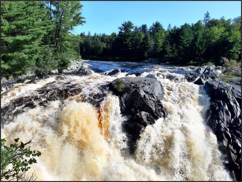
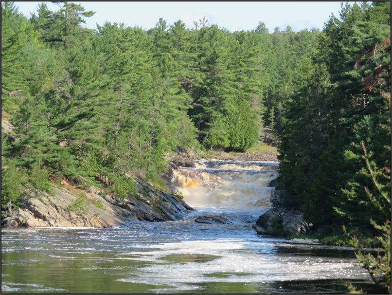
As a waterfall lover, I couldn’t miss this park again, and its Twin Bridges Hiking Trail. This 6 km trail incorporates three viewing platforms, two bridges, and countless spectacular views of Aux Sables River, and Sever Sisters rapids.

We were lucky to get the last parking spot right near the Falls, and fell quickly in awe with the strength and the energy of the main waterfalls. The amber colour of the water (caused by the pine tannins) reminded me of the Tahquamenon Falls, from Michigan state, not far away from here.

Though a tiny logging and farming settlement existed before the railway arrived, the town of Massey developed for those who constructed the railway bridge over Aux Sables River. By 1889, about 20 families lived in Massey, but the generous fields of virgin pine gradually lured more and more people.
Although so many rivers have long history as transportation routes, Aux Sable River is the best one to be remembered in this area. Each winter from late 1800’s to the 1930, trees were toppled, cut into sections and dragged from the forests onto the ice-covered river. Several companies operated in the area, so each log was identified by a company symbol stamped into one end of the log with a metal hammer. In spring, when melting ice and snow raised the river to its highest levels, thousands of pine logs were floated down the Aux Sables to the mouth of the Spanish River. The logs were sorted by their respective owners and then towed by tug boats via the Great Lakes to sawmills for processing.

Though the Canadian Pacific Railway provided regular boat service along Lake Huron prior 1880s, the actual railway really opened up the North Shore to logging and development. One of the challenges in building the railway was the crossing of the Aux Sables gorge. The original stone pillars used in 1883 were made with limestone cut on Manitoulin Island, brought by scow to the mouth of the river, and then hauled by horse and wagon the rest of the way. The first road bridge was built in 1886, entirely of wood, replaced in 1907 by a cement one, which was said to be the largest single-arch cement bridge in the world at the time.

We tried to imagine the Whitewater men in their pointer boats along this river, herding the logs safely downstream. Or just how the log-drivers would be “walking” on the mass of flowing timber. Just try to imagine these men springing from one log to another with their pike poles, watchful for the jams, and making sure the logs do not block the river, and they flow properly down the current. A tough work for sure, one of the most dangerous jobs in the logging industry back then.

Counted as a moderate trail, Twin Bridges Trail is actually easy. Although most of it is quite straight, it does certainly have broken bedrock along the way, and intertwined roots coming out from the earth, reason we had to watch our steps.

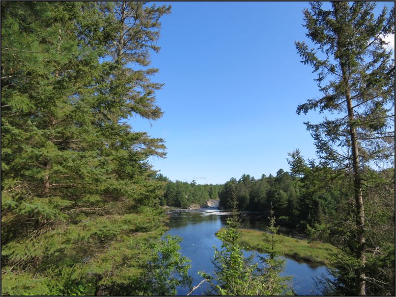
Following the Aux Sables, this trail leads to lookouts along the river. Interpretive panels at the Falls Lookout tell a bit of history of this area.

After crossing both bridges, the trail follows another stretch to another viewing platform, anyway, we stopped several times along the trail, near the river, when the vegetation allowed us to. We expected to see the main Falls from the other side of the river, but the trail didn’t arrive at the anticipated section. The trail continues along the river, and loops through the forest for a return path. We got confused at some point, as the trail has some shortcuts that are not marked on the map, but the scarce blue markers continued to show, eventually.

We arrived back in the parking lot one hour and 50 minutes later, just in time to leave the park, as the pass we requested was for two hours only.
Tip(s) of the day:
- You need to drive slowly once you are in Massey, as this is a small town, and you might miss the turn. Just follow Road 553 for about 650 metres;
- Watch your steps on the trail, as some areas are slippery in the proximity of the water;
- Wear proper footwear, since rocky are always to be expected;
- Clean washrooms are located on the left side, right after the second parking lot;
- Day permits are available for 2-hrs, 4-hrs, or all-day, for same price.
~ visited in August 2021

What a lovely place to explore and photograph, Christie 🙂 Several sets of rapids and a few small cascades along the river’s course makes the Chutes Provincial Park a very photogenic park to visit. I would love to set my tripod and capture the river running over the rocks, all while taking in the sounds and smells of surrounding nature. Thanks for sharing and have a nice day. I hope all is well. 🙂 Aiva xx.
LikeLiked by 2 people
Chutes PP was the first stop on our recent road trip up North. I was amazed at how many waterfalls were along the way, and I am not planning to have posts on all of them🙂 The rocky landscape and the abundant bodies of water make a perfect environment for waterfalls. Have a lovely week ahead🙂 xx
LikeLiked by 1 person
A beautiful stretch of river Christie. I could hear the strains of Log Driver’s Waltz as you described the logging procedure. Looks like a great place for a walk. Thanks for sharing. Have a great week. Allan
LikeLiked by 2 people
Oh, the Log Driver’s Waltz, such a lovely song, it couldn’t be a more idyllic picture of the log drivers’ way of life🙂
LikeLiked by 1 person
Looks like a great place to explore! Great sharing Christie!
LikeLiked by 1 person
Thank you!
LikeLiked by 1 person
A great site to hike around this river. Would love to see Chutes Park when we return to Ontario
LikeLiked by 1 person
So many waterfalls in Northern Ontario, you’ll love them!
LikeLike
A truly beautiful and peaceful place. Love a wild, running river and this one got me thinking about that movie ‘The River Wild’. Glad you didn’t bump into Kevin Bacon’s character.
LikeLiked by 1 person
Hehe, nope, it was quiet most of our hike, and no one was rafting on the river🙂
LikeLiked by 1 person
looks like a delightful place for a walk!
LikeLiked by 1 person
Indeed, a refreshing place to walk around.
LikeLike
Ohh… that rushing water and the falls are so refreshing. We are STILL waiting for our first rain since mid-June. Makes all that rushing water all the more delightful.
LikeLiked by 1 person
Sorry to hear it still didn’t rain over there, I would send you some rain if I could, we just had a thunderstorm last night, and heavy rain. Although we found severe drought up north in Ontario, where we’ve been on a road trip at the end of August. Combined with the smoke from the wildfires, it was all murky and hazy in some areas. The waterfalls were a blessing in those hot days🙂
LikeLiked by 1 person
Chutes is such a lovely park and the Twin Bridges Trail does not disappoint with its great views of the river and rapids. We were actually there a few days ago as the last stop on our two week Northern Ontario road trip.
LikeLiked by 1 person
Hope you had an amazing time on your road trip. Funny, the Chutes was our first stop, it has to be the first or the last one😃
LikeLiked by 1 person
I’ve driven past the sign on the highway directing one to chutes numerous times. No idea what I was missing. Next time we’ll take a little detour and check it out.
LikeLiked by 1 person
A hidden gem, isn’t it? I’m sure you will love the place when you have a chance to stop by. Thank you for following along🙂
LikeLike
Maybe next time we’ll stop, looks like a nice hike and waterfall. I often wonder about the men who first built the bridges and roads through our rough wilderness. Tough job! Maggie
LikeLike
Tough job, indeed, not only because of their limited resources, but especially due to so many lakes, and rivers across all Canada..
Thank you, Maggie!! xx
LikeLike
Such beautiful views of the river … can see why this would be a great short hike! And must say, I would not want to have the job of the log-drivers – that sound way too dangerous to me!
Great photo’s – thanks for sharing 😊.
LikeLiked by 1 person
I would never imagine myself stepping from a log to another, either LOL
LikeLiked by 1 person