
Located in the northeastern part of New York State, the Adirondack Mountains are about 5 hours north of New York city, or 5 hours east of Toronto. Representing the largest protected area in the contiguous United States, the Adirondack Mountains boasts with more than 2,000 miles of hiking trails, over 3,000 lakes and ponds, and 1,200 miles of rivers. They cover about 5,000 square miles (13,000 km2).
We had not yet unpacked our bags, returning from our trip to Newfoundland, when my husband informed me that we would soon be visiting the Adirondacks. Caught by surprise, and not having enough time to do the logistics, I was adamant at first. But the bigger surprise came the following day, when he presented me with a 3-day schedule, with trails, stops, accommodation, and everything else set up. How can one say no?😊
And here we go, a five-hour drive to this beautiful area. The Adirondack Mountains form the southernmost part of the Eastern boreal forest, meaning that it is heavily forested, and with a wide variety of trees. These mountains are one of the first places to receive Forever Wild status in the United States. They offer any kind of adventure in every season for nature lovers.
Over millennia, as glaciers carved the landscape, these mountains began to shape. Unlike the Rockies or the Appalachians, the Adirondack Mountains do not form a connected range, but rather a 1260-miles wide dome of more than 100 peaks. Although the mountains are formed from ancient rocks more than 1,000 million years old, geologically, the dome is a newborn. Because of this, the Adirondacks have been referred to as “new mountains from old rocks”.
The Adirondack Peaks can be anywhere from 1,200 feet tall to over 5,000, and the 46 tallest summits above 4,000 feet are called the High Peaks. Not ready to hike the top ones, we were rather the novices looking to do some relaxing hikes while getting to know better this area.
Cathedral Rock Fire Tower, Wanakena
Our first stop was in Wanakena. With no physical map, GPS or cell service we were like bats in broad daylight, looking for the trailhead to the Cathedral Rock Fire Tower.
As the small parking lot across the footbridge was full, we pulled over along the main street. Fortunately, we spotted soon a board with mapping and tourist information.

After a short walk to the footbridge in Wanakena, we turned around and found the Latham Trail trailhead, located behind the Ranger School. The hike is very easy, about 2-mile round trip, with 1,700 feet of elevation.
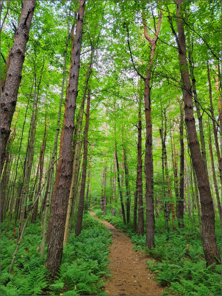
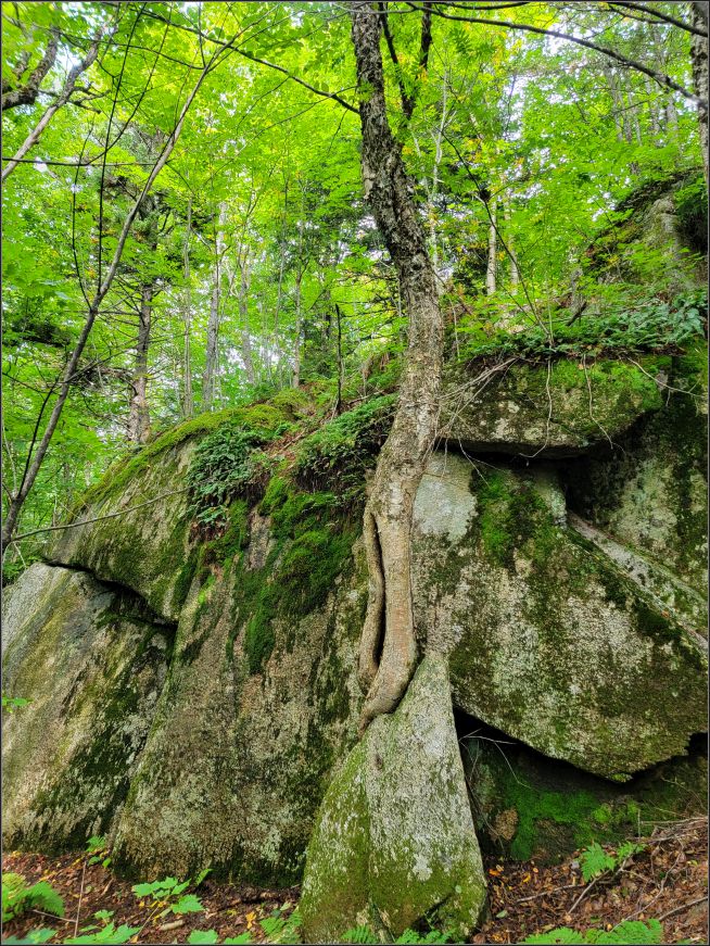
As soon as we started, the earthly scents of the wood, moss and pine trees enveloped us, making me realize how much I missed a good walk in the forest.
Our trail crossed an adjacent path several times, probably used by the rangers in training. It was just us in the forest and no one else. It was a nice feeling, very refreshing to have the whole forest just for us.
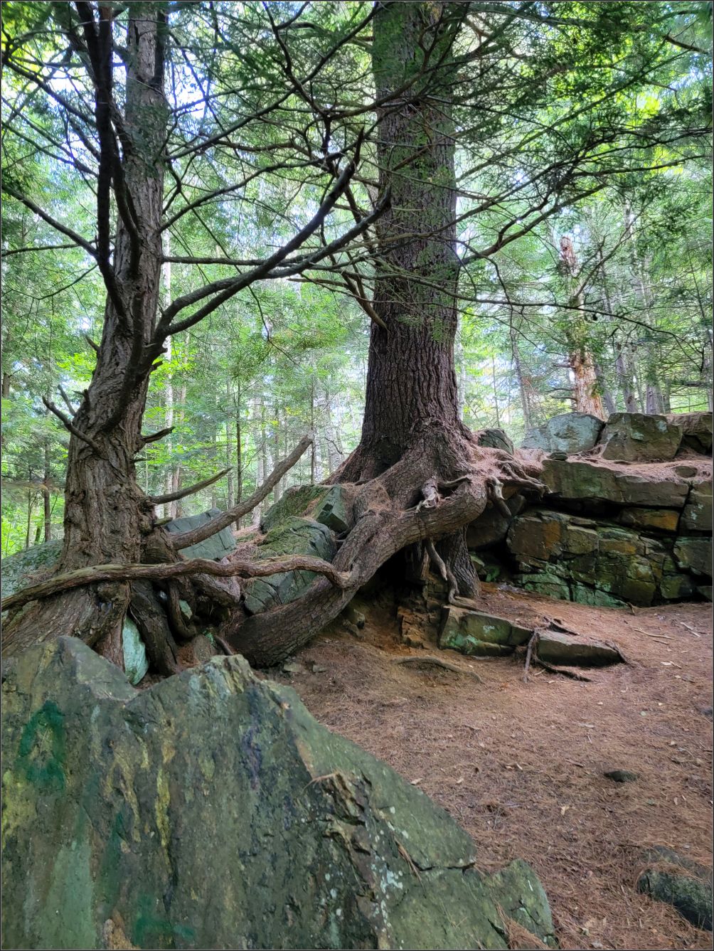
The path is marked very well, leading through the forest the entire distance. The first stretch of the path is fairly straight, but later we had to watch our steps and the pine trees intertwined roots.


Lumbering, once an important industry, was greatly restricted by the creation of the state forest preserve, which can be seen along all roads in this area. Since the forests were so precious to the residents, as there was practically no other means of living, several Fire Towers were built at the top of these mountains, to monitor if there was fire, or smoke nearby.

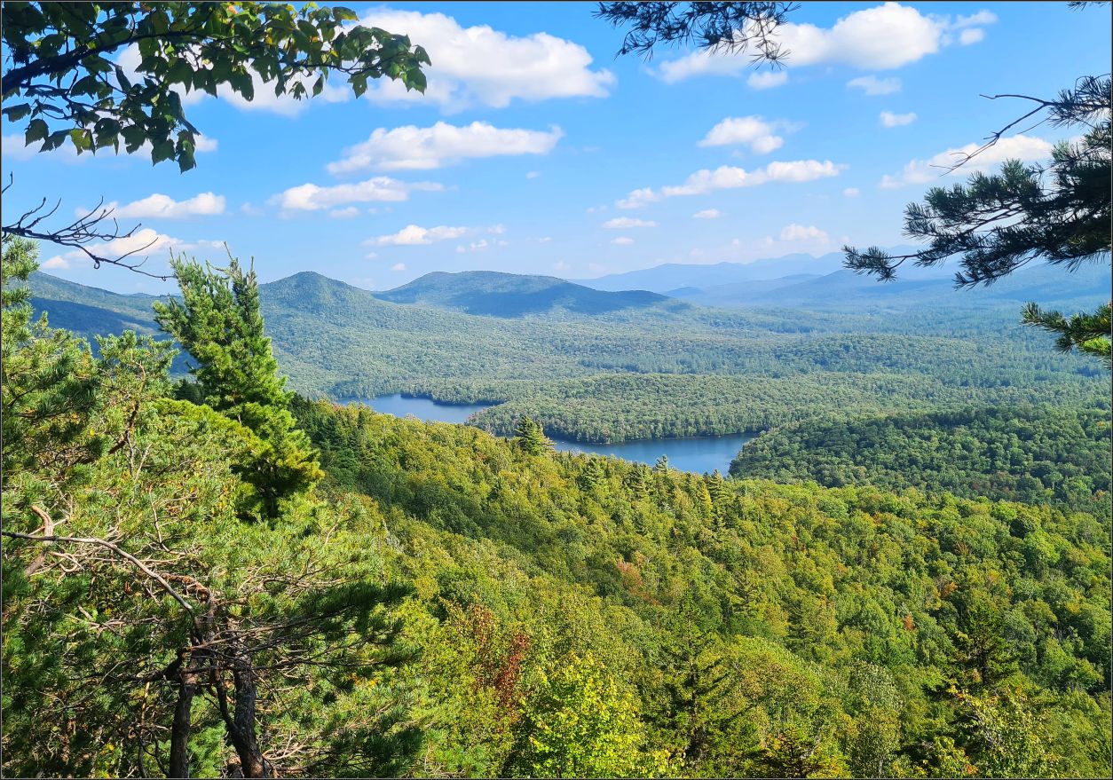
As we neared the end of the trail, we came across the Picnic Pavilion, where we took a short break. The fire tower came shortly after to our view, and we climbed it in a minute. The wind started to pick up at this height, which made me a bit uncomfortable. After enjoying the view of the surrounding mountains, and taking few deep breaths, we began descending carefully, as the upper stairs are quite narrow.
If you would like to explore New York State, you might like to read about Finger Lakes Region.
***
Mount Arab Fire Tower, Tupper Lake
After leaving the car in the parking lot across the street with the same name (Mt Arab Rd), we headed to the trailhead of Mt. Arab Fire Tower, which is reputed to be one of the most popular hikes in the Adirondacks. Rated moderate, this is a 2-mile round trip, with an elevation of 2,545 feet. There is a sign-up book at the head of the trail, one person per group can sign in & out, if they wish to.
The trail started with a steady slope, which became steeper toward the end of the trail. Friends of Mt. Arab, a non-profit organization is well known in this area for maintaining the trail, the tower and the cabin at the top. We were very pleasantly surprised that many ditches and small stone walls were built along the path, to divert the water during the rainy seasons. Restoration was still in progress, as we had a little detour going around some of the big boulders. We were later told that several large stones were recently cut in half by drilling, so that a stone staircase was built in some sections of this trail.
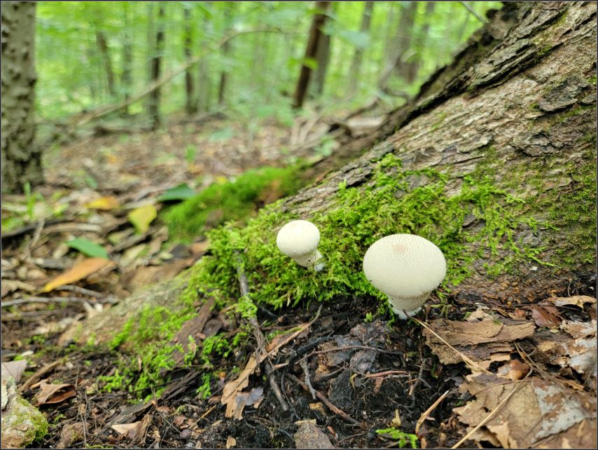
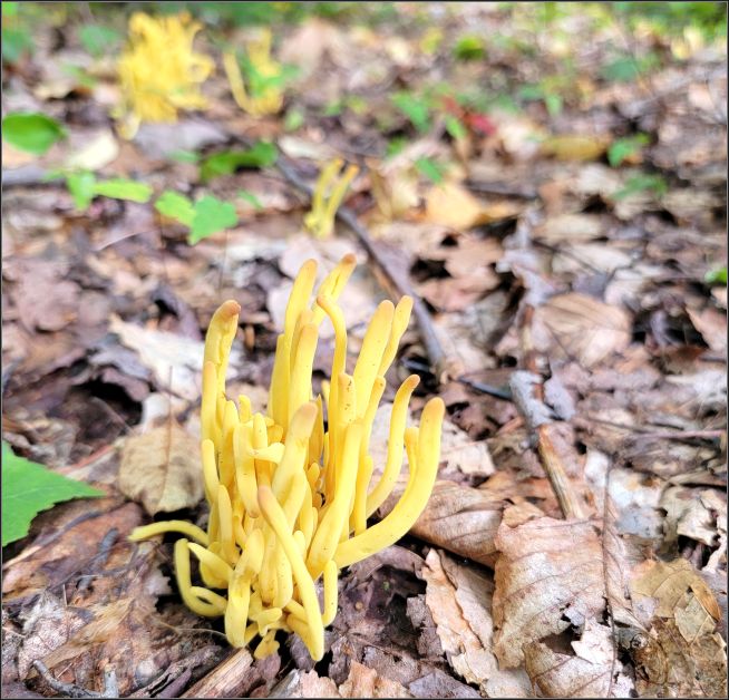
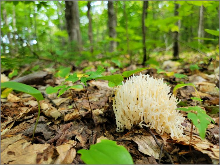
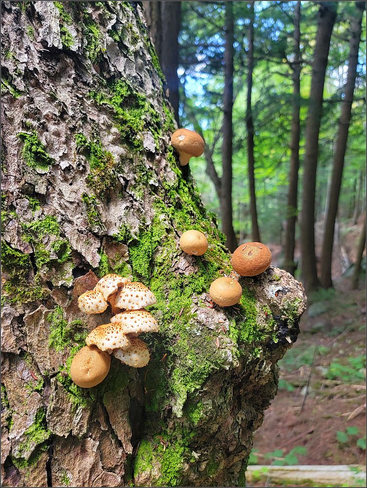
The trail leads through the forest, and with all the rain throughout the summer, the vegetation was full in all its splendor, a variety of mushrooms, mossy areas and leafy vegetation along our way.
After a pleasant hike in the woods, we had another nice surprise to be welcomed by one of Mt Arab’s friends at the top, who kindly volunteers twice a week, coming to the cabin, and providing the hikers interesting information.

Built in 1918, the current fire tower is one of the few original towers still standing up on Mt Arab. Being in service for over 70 years, such towers played a vital role in monitoring the forest fires or smoke sightings. The Bell Telephone Company built the telephone line in 1912, and in the early 1940’s, radio communications were established between each of the 57 towers located in the Adirondacks.
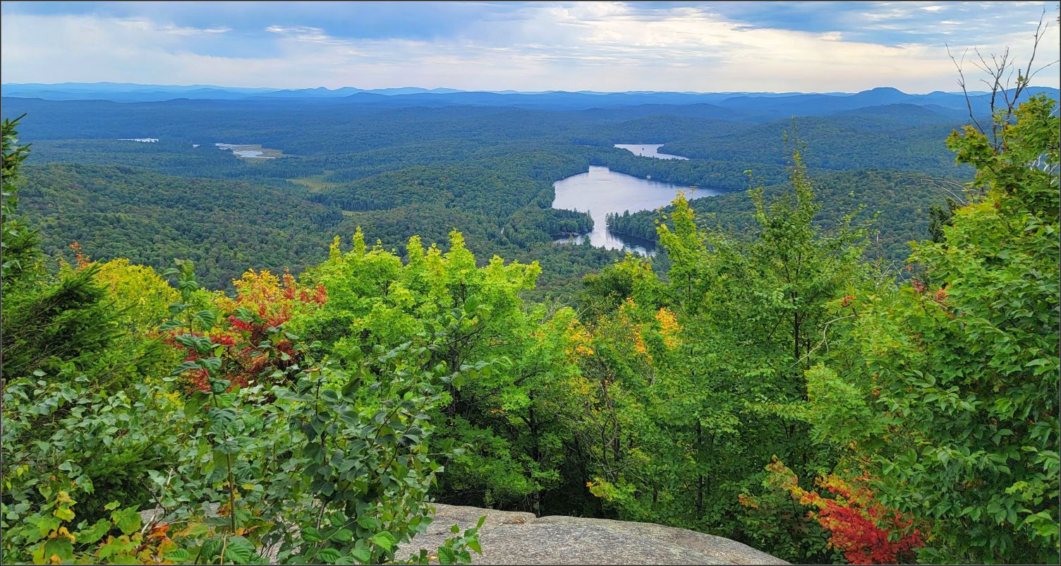
The tower offers incredible views of the surrounding areas, endless stretches of virgin forests, including Eagle Crag Lake, Mt Arab Lake, Tupper Lake and all the surrounding mountains.
A very rewarding hike, we found a bench at the end of the path, where we could rest while having a snack. As some clouds were fast approaching, we packed up quickly, taking same route back to the parking lot.
If you like hiking, and need few ideas, you can read about Best hiking trails in Killarney Provincial Park, Canada.
***
Panther Mountain Trailhead, Tupper Lake
With 46 High Peaks, the Adirondacks offer a great chance to avid hikers to become a “46er” once they complete all 46 hikes. When I saw Panther Mountain trailhead on our list, I could not believe what my husband planned for me; but don’t worry, I’ll do it baby! Although I am aware of my physical limitations, I do like to challenge myself, and get out of my comfort zone.
The little surprise came after we reached the peak, noticing the marker at the top that stated ‘1963’, and not 4442 ft that Panther High Peak actually has. Deceiving as it was the naming of this trail, it was still an amazing hike.

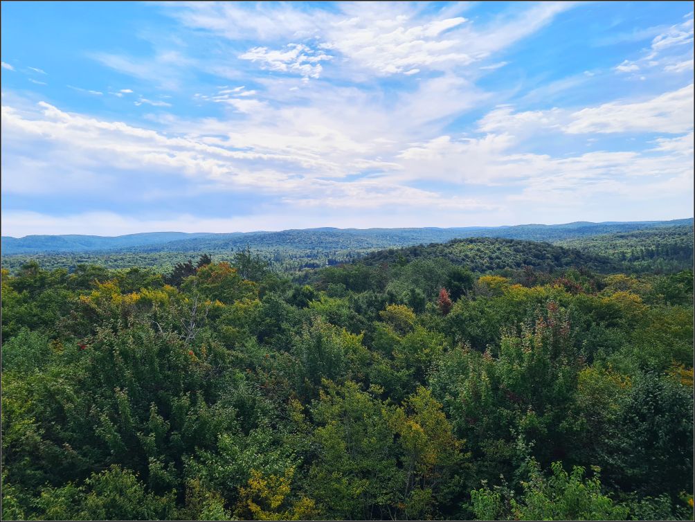
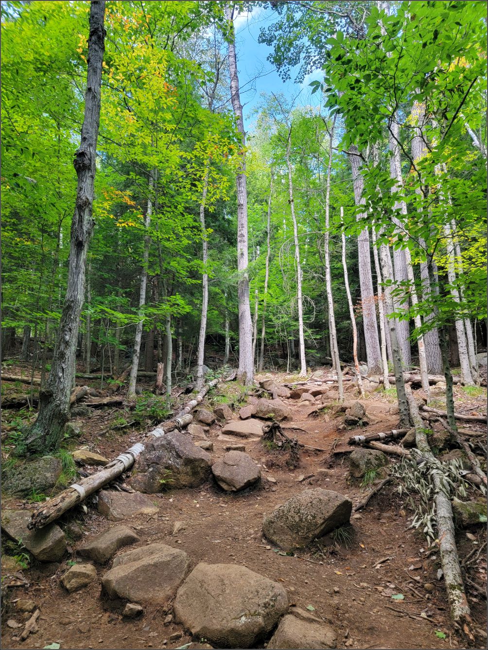
As the fall creeps in, the foliage is slowing changing colours, bringing alive new shades in the forest. These mountains are known for their brilliant colours, and one of the longest foliage seasons on the East coast. I think September is a great time visit these mountains, as we could admire the new foliage colours, the wild flowers, the mossy vegetation, and a big variety of mushrooms along the way.


The view from the top is quite obstructed by the vegetation, but overall, it was a nice hike. The trail was in good condition, little steep at times, and with plenty of entertainment along.

If you like hiking, and looking for some trails and waterfalls in NY State, you can read about Letchworth state park.
***
Baker Mountain Trailhead, Saranac lake
The afternoon was already getting hotter and I didn’t want to waste any more time. The humidity was rising, and unfortunately, I wasn’t dressed properly, thinking this would be a coolish day like the previous one.
The Saranac Lake 6er Challenge consists of 6 hiking trails in the region. Baker Mountain is the shortest one, at around 2 miles round trip. But don’t be fooled by the length. The hike is still considered one of the toughest by locals, with an ascent of 884 feet, to the summit at 2,452 feet.
We started the hike in full force as the trail begins with a considerable incline, which progressively got steeper. The winding path definitely tested our hiking abilities, as the rocky landscape was totally different than the mossy trail at Panther Mountain. As treacherous as it was, this trail has definitely kept our eyes on the ground. It seems that more and more rocks appeared along the path, and many roots wanted to hinder our walking. But we are not to give up easily, and we learned our way, trying to use them as a ladder instead, finding the best spot to step over, for a good balance and speed.
We took a couple of breaks along the way, catching our breath for a bit here and there, and kept moving along the trail. This is also an easy-to-follow trail, but not well marked as we were about to find soon.

Coming to a wall of all kind of boulders, we decided to go to the right, as it seemed that the trail was well beaten in that direction. Soon we heard some voices to our left instead, realizing we were not heading to the right direction. My husband, in a spirit of adventure said to keep going, as we’re almost at the top. We haven’t scrambled big boulders in a long time, so why not doing it now?!

Agile as two goats, shimmying up the boulders of various shapes and sizes that kept popping up on our way, we finally made it to the top. It wasn’t the best idea to keep walking off the path, but happy to finally make it to the top, after a bit of excitement.

This peak overlooks to more than 20 other mountains and several lakes. Finding a spot with a view took us a bit, as the best spots were taken already. What more could you ask than having a snack with an amazing view!
The heat of the day made it a bit hazy over the distance, but it was a well rewarded hike nonetheless. It took us less than two hours in total, including few breaks along the way.
If you are looking to see the fall foliage at its best, then you might want to find more about Green Mountain National Forest, Vermont.
***
Once back to Saranac Lake, we definitely slowed down the pace, trying some local beer with our friends who were patiently waiting for us in the city.

Tip(s) of the day:
* Make sure you have a map of your interest area, as there is no cell service, or GPS signal, except the main towns, or at the top of the mountains;
*The trails are often rough with rocks and exposed roots, wet, or muddy. Just be prepared for any kind of weather and trail conditions.
~ visited in September 2023

My sister and her family have gone to the Adirondacks for years, but I’ve never been there. I had no idea there were hikes with that much elevation gain; I’d better get up there and try some!
LikeLiked by 2 people
We didn’t know much about Adirondacks either, but we loved them! I have a couple of more hikes in my mind already😉
LikeLiked by 1 person
What a great surprise! Love the view from Mt.Baker, thanks for being a goat and sharing the views. 😊 Maggie
LikeLiked by 1 person
Hehe… thank you Maggie😊
LikeLike
I didn’t realize that the Adirondacks were so close to Toronto. This is another spot for us to add to our list. We’ve only ever been in the winter (we drove there from Boston) where the landscape looked so different compared to when you went in September. Looks like a great (but challenging) spot to hike and I love how there are so many fire towers. Great shots of the surrounding area!
LikeLiked by 1 person
It is actually between 5 and 6 hours drive, depends on where you’re planning to stay. We stayed in the North-West part of the mountains, but planning for next year few more trails closer to Lake Placid.
Happy Friday!!
LikeLiked by 1 person
Wow, what a truly beautiful place to explore, Christie! I had to look it on the map and, much to
my surprise, discovered that most of New York State actually consists of rugged, undeveloped mountains that you could spend weeks exploring and not see it all. With lakefront resorts, tons of hiking trails to choose from, and beautiful landscapes, it must be a great place to visit in autumn to enjoy the fall foliage. Thanks for sharing, and have a wonderful day 🙂 Aiva xx
LikeLiked by 1 person
There are so many parks and trails, and so much more to explore in NY state. I have already made plans for next year, to hike few more peaks of the Adirondacks. So much good energy there🙂
Thank you!! xx
LikeLike
The name always sounds romantic and wonderful to me, and I always picture them with Fall colours. Thanks for all the details, Christie.
LikeLiked by 1 person
We went at the beginning of the fall season, so the foliage was not at its best yet. I’m thinking to go back next year, but a month later, to see the true fall colours.
Thank you for stopping by🙂 xx
LikeLiked by 1 person
💚
LikeLiked by 1 person