A land of ice and fire, the lesser-known Kootenay National Park in British Columbiais a place of contrasts, with valleys and canyons carved by glaciers, rivers and waterfalls. At just 1,406 km2, Kootenay is much smaller than Banff. Created in 1920, Kootenay National Park is one of the seven contiguous national and provincial parks that make up the Canadian Rocky Mountain Park World Heritage Site. It also marks the Continental Divide which is the boundary between Kootenay and Banff national parks. Only a short drive from Lake Louise or Banff, it’s a great day trip destination if you’re coming from here.
The park stretches for 94 km along Highway 93 (Banff-Windermere Highway), running from Radium Hot Springs in the southwest to Vermilion Pass in the east. The entire distance is actually a great road trip, as beautiful landscapes and pristine mountains line up one after another, but there are also great stops and shorter or longer walks to some of the lookout points along the way. Our picks for the day were: Stanley Glacier and Marble Canyon.
Stanley Glacier Trail
Inly 24-minute drive from Lake Louise and 15 km from Castle Junction is the small parking lot at the Stanley Glacier Trailhead, right off Hwy 93. It is a popular destination for hikers looking to escape Banff’s crowds. The parking lot fills up quickly, and we saw many cars parked on the shoulder of the highway (which I wouldn’t recommend), so it’s best to arrive early to secure a spot on weekends and during peak season.
The trail begins right after crossing a bridge over the Vermillion River, through a recovering fire-swept forest, traversing a gentle slope. The nature is recovering well and looks quite healthy after the 1968 wildfire. Tall shrubs and sun-loving lodgepole pines are now predominant tree species for the first part of the trail, which gave us a wonderful feeling of being again in the woods.
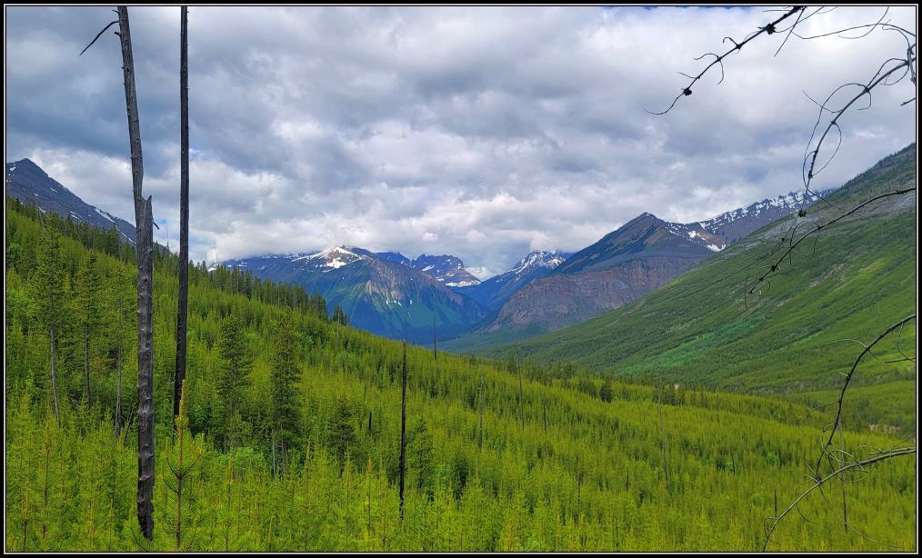
After a couple passed us, I started to wonder how isolated this trail actually is, because while I love hiking in the woods, being just by ourselves in the bear country doesn’t make me fell too comfortable. But after a rainy day, 2 days of smoke, and some disappointment seeing that some hiking trails are either closed or not recommended, here we are, enjoying the beautiful skies and pleasant temperatures.
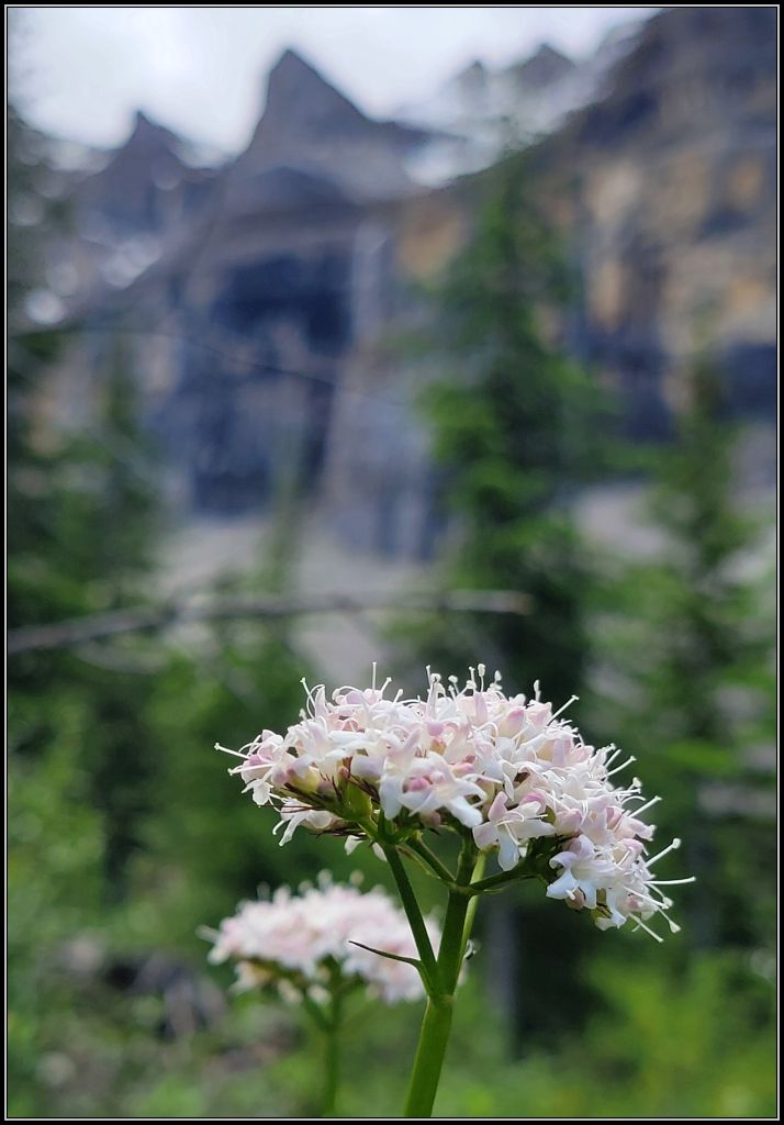
Meandering through the scenic surroundings was the perfect way to immerse ourselves in the park’s natural beauty, and soon we could hear a powerful waterfall. Instead, we came across a rushing creek cascading down a very steep slope, a great time for a refreshing break.
Archaeological evidence suggests that humans inhabited this area for about 10,000 years ago, but what is even more interesting is that fossils from the Burgess Shale, one of the world’s most important fossil deposit, have been found here. These sites preserve rare fossils of soft-bodies organisms that lived in the Cambrian Sea, 505 million years ago. If you are interested, you can book tours with Parks Canada to see them.
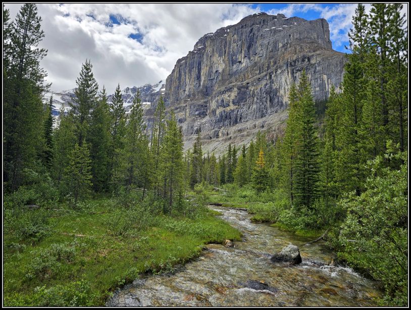
The trail climbs gently and after a while we started to catch glimpses of the valley with the imposing Mount Stanley above the tree line. After about two km into the trail, we crossed Stanley Creek, and that was about the point where the forest opens up, offering more views of what lies ahead. Once in the valley, the trail levels out for a while, paralleling the sheer walls of Stanley Peak to the west.
The cliffs and walls of Mount Stanley began to reveal themselves and we were so eager to reach the top of the trail in anticipation to see all its splendor.
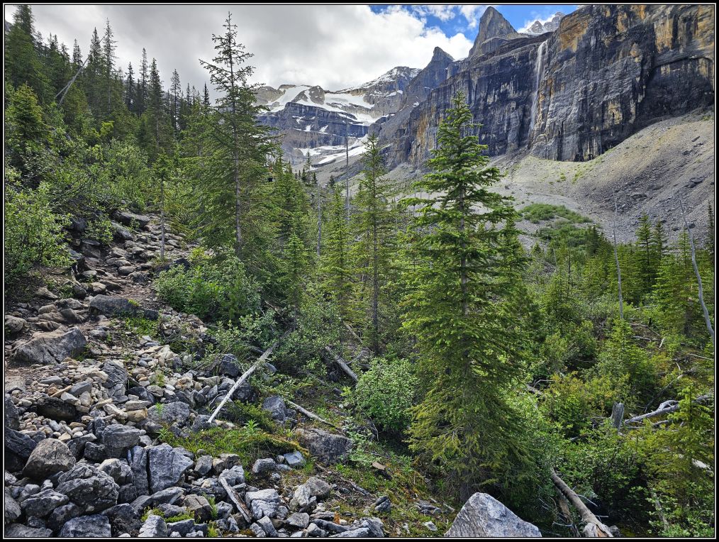
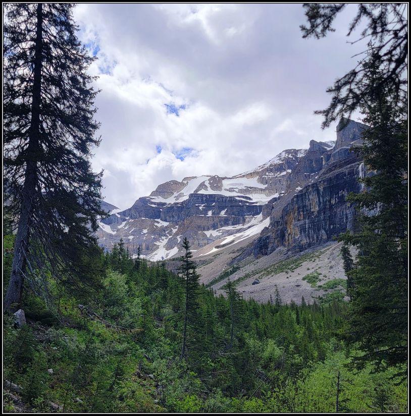
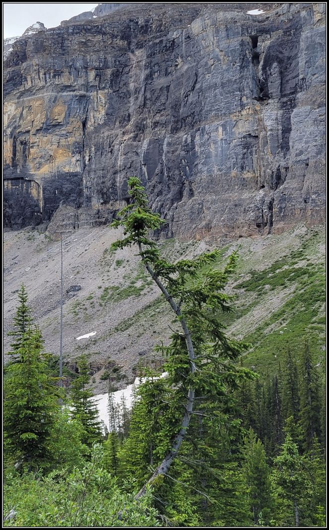
Eventually we left the forest and started to slowly climb talus slopes. Although the dark walls and a huge waterfall were beckoning us like a magnet, we had to watch carefully our steps as rocks and boulders continued to appear along the path. After another steep climb we reached an alpine plateau where we found people sitting on the rocks, enjoying the surroundings.
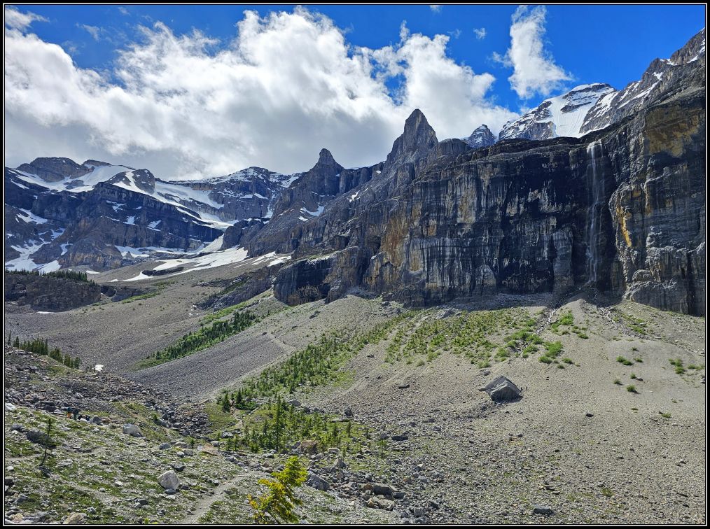
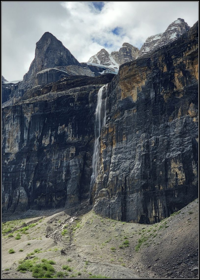
Officially the maintained trail ends here, after about 4-km mark, where a lookout offers excellent views of the surrounding cirque, the large waterfall and bits of Stanley Glacier, one of the Rockies’ hidden gems. We saw a few people in the distance heading for the falls, but I realized that no matter how close you get, the falls are still further away. We decided we had reached the best vantage point for the view (and a guide of a large group that had just arrived confirmed the same thing) and chose not to continue our adventure on this trail. I wondered for a moment what it would have been like to hike the rest of the trail along the precarious scree of the steep mountain slopes, but at the same time, I was content to save our knees for the way back.

The trail operates as an out-and-back trail, so the return was on the same way that we came. Although we’ve had to deal with the same steepness and loose rocks, the return was much easier and we were happy to get quickly to the parking lot.
Tip: we did the maintained section of the trail in 3 hours, roundtrip, but if you plan on hiking the full hike, you can allow up to 6 hours. Although it is only 200 m to the Glacier from this point, to the rock cairns and the small forest island located in front of the glacier where the trail ends, this is the most difficult section, as you have to cross the steep scree field.
Many thanks to Maggie from Monkey’s Tale for this inspiration.
Marble Canyon
Four kilometres south of the Stanley Glacier Trailhead is Marble Canyon. At less than 1 km long, this is the easiest trail you can find in the area and also one of the most stunning places in the entire national park.
Once a junction of two glaciers, Marble Canyon is actually the side valley gouged less deeply by the smaller glacier. As both glaciers retreated, the small valley hung high above with a drop-off to the main valley floor, which is where the highway is now. Meltwater flowed over the spillway, creating a waterfall. The water began to erode the bedrock beneath, forming Marble Canyon.
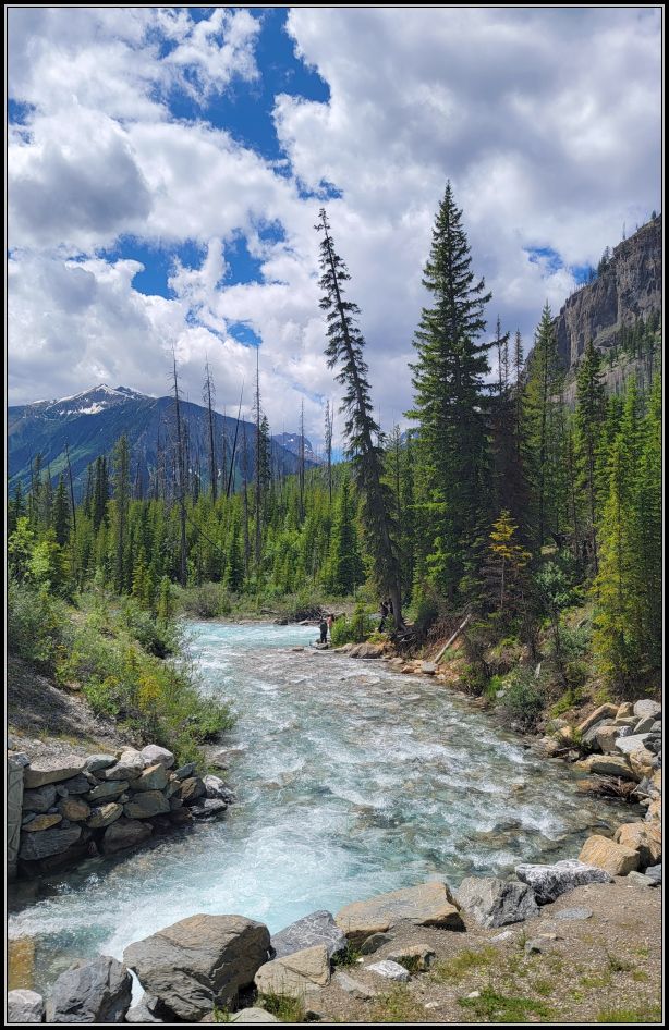
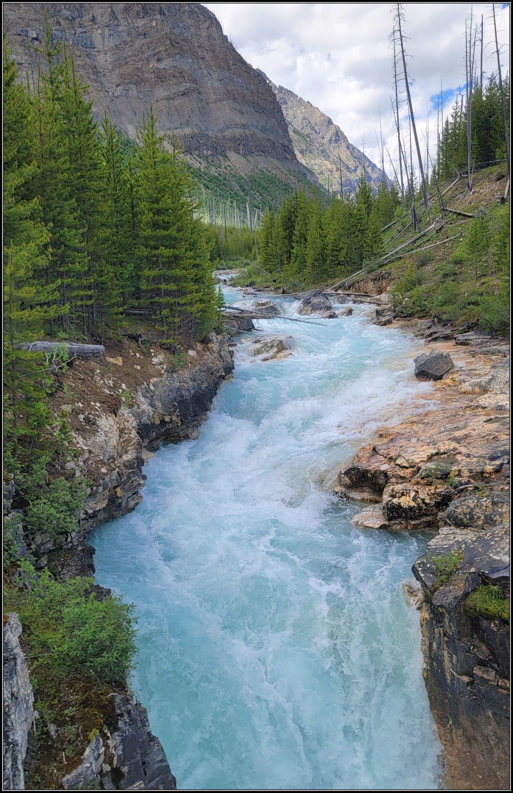
The trail starts right from the parking lot and we were blown away at the first sight of the Kootenay River. Although we have seen other rivers with this colour before, the intense turquoise hue was truly mesmerizing. The rushing waters seem to deepen as the limestone walls get higher, creating dramatic views of a different kind of landscape. Natural stone bridges and cascading waterfalls provide captivating scenery and we walked fascinated, following the river and the path.

There are seven footbridges that cross Marble Canyon, and we criss-crossed them from one side to the other alternately. The path is level and we didn’t really notice any elevation gain until we really looked into the depths of the canyon. The highest drop spans 39 meters, and at some point, we could barely see the water at the bottom of the canyon. Every corner of this water-sculpted gorge offered us a different perspective of what Mother Nature has chiseled for us.
Despite its name, Marble Canyon is not made of marble! The rocks are limestone and dolomite that look like marble when wet. Silt and pebbles in the water grind down the rocks, wearing away the walls of a fault, sculpting and deepening the already deep crack.
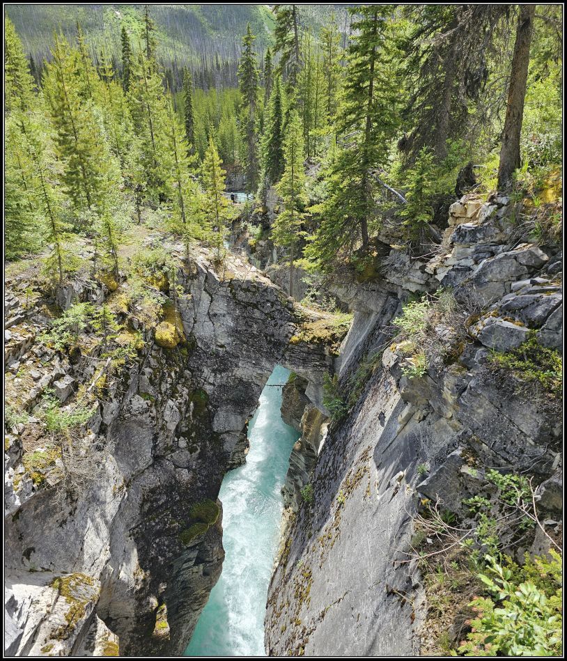
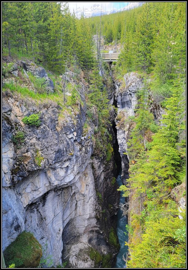
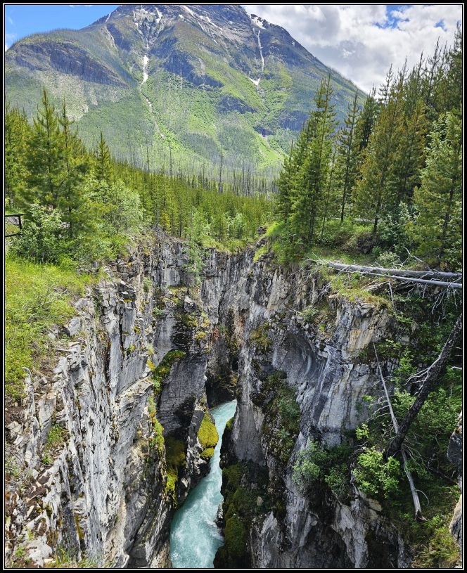
Descriptive panels provide interesting information along the way. This is how we learned that the canyon’s harsh growing conditions are similar to those in alpine areas, 800 metres above here. Glacier-fed water and cool mist keep the canyon up to 100C colder than its surroundings.
The last bridge crosses the largest drop of the river, both in height and volume, and the colourful shades of the surrounding rocks highlight the turquoise colous of the water even more. The last section of the trail, where the red chairs should have been, was closed due to some puddles, but we managed to take a few more photos before leaving. It took us about 40 minutes to complete the entire 1.8 km roundtrip.
Kootenay National Park is famous for several other hikes and viewpoints, like Numa Falls, Ink Pots, and if you head further west, you can enjoy the breathtaking views of the Mitchell and Vermilion mountain ranges from the Kootenay Valley Viewpoint. I would have liked to visit the village of Radium Hot Springs before returning to Lake Louise, but we decided to save few more places for next time.
Tip(s) of the day:
*Summer is the busiest season. Some parking lots can be full by 7 am like Lake Louise, or by 9-10 am at other popular places such as Johnson Canyon, Stanley Glacier. Parking is very limited at all major attractions, so plan ahead and have an early start of the day;
*If you want to visit these parks, you need to plan ahead, including lodging, car rentals, camping, or any other services or reservations you might need;
*For a first-time trip, plan for a 7 to 10-day road trip between the National Parks. You can download the visitor guide from Parks Canada website for more information and inform yourself about trail condition if you’re planning to hike one;
*Respect the wildlife and remember this is the bear country; bear spray is highly recommended if you plan to hike in the wilderness. Proper disposal (dropping it at a fire station) is required if you leave the area and not using it.
~visited in July 2026


It’s a beautiful park.
LikeLiked by 1 person
Yes, it is. Happy Tuesday, Lynette!
LikeLiked by 1 person
I love the Kootenays, but our last few times there have been in the winter for backcountry skiing, so it’s nice to see it in summer again through your pictures. You chose two good alternate trails. Maggie
LikeLiked by 1 person
We enjoyed these quieter places so much🥰
Hope your summer goes well, I’ve heard you are going to have a warm fall, which sounds amazing!
xx
LikeLiked by 1 person
I think so, but also not much snow in the mountains this winter, so that’s not great. Can’t have it all 😊
LikeLiked by 1 person
😊😊
LikeLike
I’ll try to remember to come back because my phone doesn’t do this justice and I’m in transit. Looks beautiful xx
LikeLiked by 1 person
It was beautiful, and sometimes the pictures themselves don’t do justice. We’ve had an incredible time in the Rockies.
Happy Tuesday, Jo! xx
LikeLiked by 1 person
Magnificent scenery
LikeLiked by 1 person
Thank you, Sheree, the Rockies are magnificent!
LikeLiked by 1 person
Thanks for the summer pix of Marble Canyon Christie. We were there in April, when it was still locked in snow. Have a great day. Allan
LikeLiked by 1 person
We love seeing waterfalls during in the winter. I’m not sure what Marble Canyon looked like in the winter, but I bet those majestic mountains looked incredibly beautiful!
Happy Tuesday!
LikeLiked by 1 person
Wow – these two hikes are both awesome-looking for different reasons! The first one is the kind we often seek out (and I also have a few moments of scary bear thoughts!), and the second one honestly blew me away with the water color and the dramatic canyons. (Kind of nice to get that kind of scenic reward with less effort, too!) We simply must get back to western Canada again.
LikeLiked by 1 person
We didn’t see any bears the entire time we stayed this summer, compared with 10 years ago when we saw 2 or 3. But we stayed alert and had the bear spray handy!
The Marble Canyon was indeed an easy walk. A very rewarding place with minimal effort!
xx
LikeLiked by 1 person
The colour of that water is unreal, looks like its been photoshopped or something. There was similar coloured water in the Dolomites in some of the Lakes but that river is just amazing
LikeLiked by 1 person
To be honest with you, I’ve never seen this colour in a river. Lakes, yes, but not rivers.. it was such a bright colour I couldn’t believe myself either!
The Dolomites are on my list, I understand they are amazing!
LikeLiked by 1 person
They are superb, going again next year
LikeLiked by 1 person
Beautiful Christie, and a great reminder to me of just how beautiful the Canadian Rockies are. Both trails were fantastic and provided a very different perspective. The river is gorgeous. Having lived in Alaska for three years, I’m quite familiar with glacial rivers, but still other worldly! Thanks for having me along!
LikeLiked by 1 person
Welcome, Curt, glad to have you along🥰
I’m sure you’ve seen so many glacial rivers and countless towering mountains but each one seems to have its own beauty, doesn’t it?
xx
LikeLike
Yes it does, Christie.
LikeLiked by 1 person
Beautiful! I’ve never been to that part of Canada, but I’d like to see it one day.
LikeLiked by 1 person
In my opinion I think it’s the most beautiful part of Canada. Who knows, maybe you will visit it one day?🥰
LikeLike
Gorgeous! I came close to, but did not visit Kootenay National Park while on my Banff trip across the province a couple of years ago. Looks like I missed out, especially with that glacial blue in Marble Canyon! Hope to return to that part of Canada to check it out 😊
LikeLiked by 1 person
If that was your first time in the Canadian Rockies then you definitely didn’t have time. That’s what happened to us when we visited Banff and Jasper 10 years ago; even now, I feel that there was so much more to explore! But there’s always next time, right?😍
xx
LikeLiked by 1 person
We visited Kootenay for a day when staying in Lake Louise a few years ago. I wish we had more time to explore it more fully. It’s a good excuse to return someday though! We’ll have to add the Stanley Glacier Trail to the list as we haven’t hiked that one before.
LikeLiked by 1 person
There is such a high density of parks and places to visit in the Rockies, that it seems like you can never cover them all. I already have a few more places in mind to see for next time🥰
Hope you can hike Stanley Glacier Trail some day, amazing views of the surrounding mountains!
LikeLiked by 1 person
Oooh, adding Stanley Glacier to the itinerary for next summer! It looks beautiful! Thanks for the tips on how best to visit, too.
LikeLiked by 1 person
You’re very welcome! This was our second trip in the Rockies and we focused on a few trails, but if it’s your first time there, it’s a bit difficult to cover a lot. There is so much to see and do!!!
Happy planning! let me know if I can help with anything! xx
LikeLiked by 1 person
It’ll be my 4th time (I think) but my husband’s first, and we’re determined to hike as much as we can. But I know we won’t be able to do everything I want to do. I’ll definitely reach out though once I start really pinning down the itinerary.
LikeLiked by 1 person
Great post and such wonderful photos. Kootenay National Park might be much smaller than Banff, but it is equally stunning, with all that beautiful mountain scenery and dramatic canyons. It certainly looks like one of the most beautiful places to visit in Western Canada. Thanks for sharing, and I hope you have a cosy and colourful autumn season 🙂 Aiva xx
LikeLiked by 2 people
Hi Aiva, glad to hear from you🥰 Kootenay was a nice surprise for us, and the hike to Stanley was one of our best hikes in the Rockies!
Fall colours are at their best at this time in Ontario, and we try to enjoy every moment.
Hope you and your family are well, and the girls enjoy their back to school days❤️
xx
LikeLike