
First time we visited Manitoulin Island was back in 2017, when we did a road trip around Huron Lake, one of the five Great Lakes of North America. This time we decided to take more time and do a road trip around Manitoulin Island itself, searching for the island lighthouses.
Manitoulin Island is the world’s largest freshwater island, and it is considered by natives The Heart and Spirit of the Great Lakes of Canada. Home to three distinct cultures – First Nations, Francophone and Anglophone – this region has a diverse culture and a rich history. The island itself is considered sacred by the Native Anishinaabe people, who identify themselves as the People of the Three Fires.
With fond memories of our first visit to Manitoulin Island still fresh in our mind, we were not so lucky this time to book a reservation with MS Chi-Cheemaun Ferry Service, as due to Covid-19 restrictions, the passenger capacity could not exceed 50% of the vessel’s certified capacity hence we could not find spots available for our August trip.
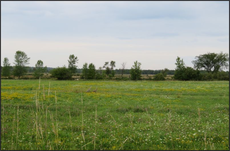
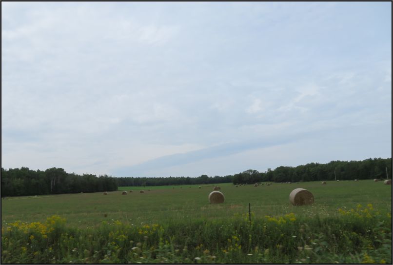
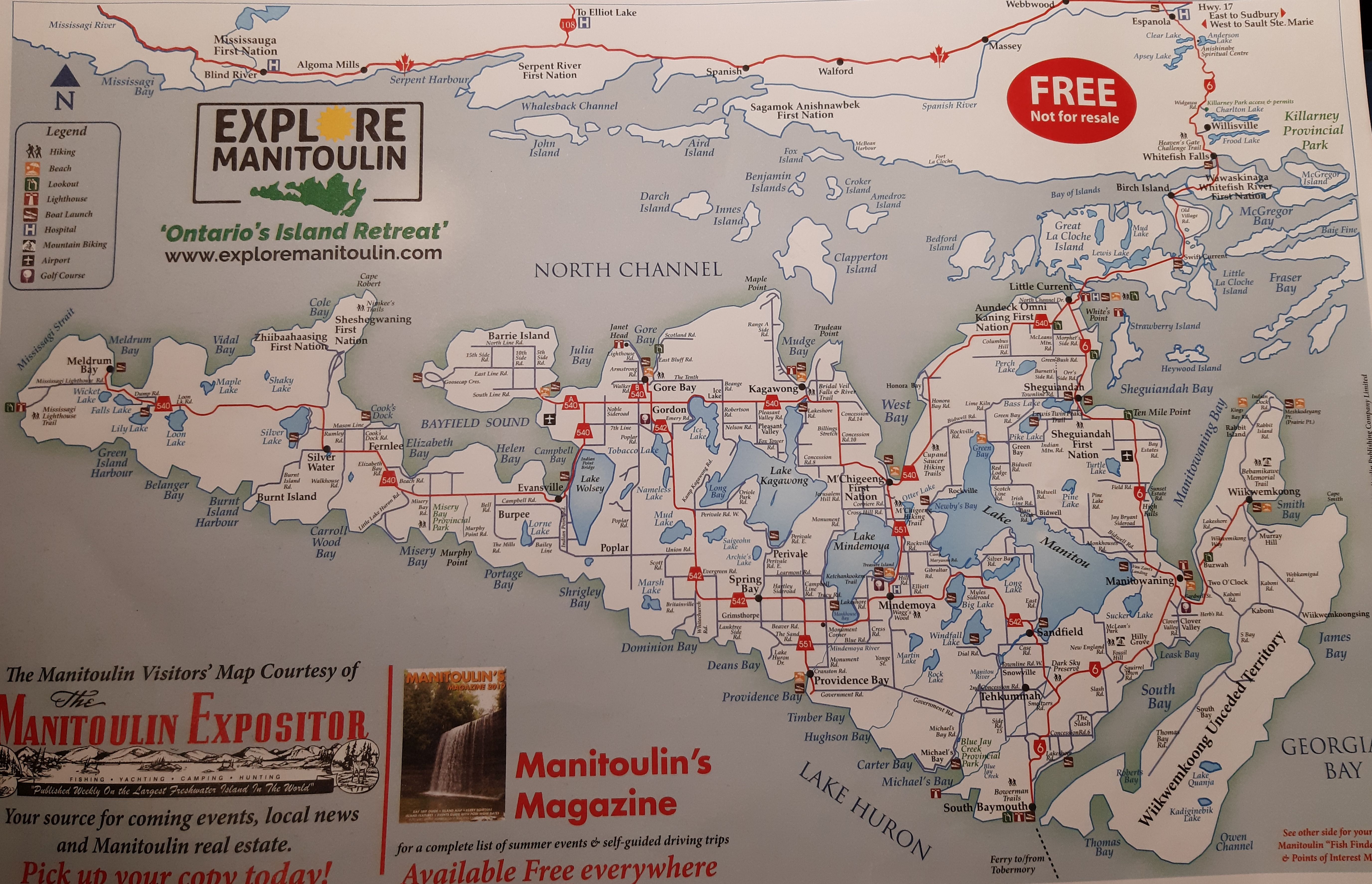
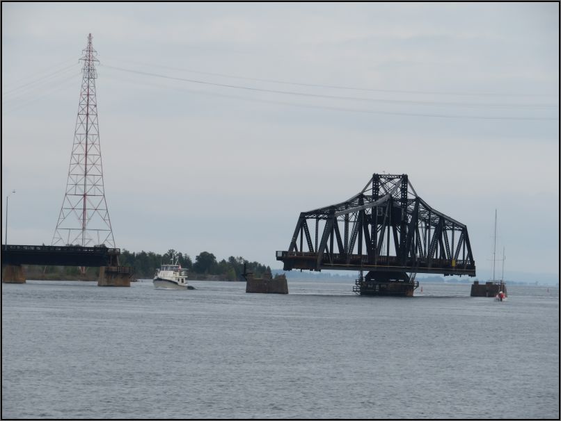
With an area of 2,766 km2 (1,068 sq mi), Manitoulin island is the largest fresh water island in the world, large enough that it has over 100 inland lakes itself. That might sound overwhelming, but in fact the island is quite small. An island of many wonders, with pristine lands and quiet beaches, it’s also offering some cultural and unique experiences. For those who love adventure, the little communities host many different festivals during the summer. But what we looked for was the peace and the serenity, the fresh air, and the untouched lands. We wanted to absorb some energy and to relax, to enjoy the views and to learn a bit about the local history. With the help of a map from the Tourism Information Centre right after crossing the swing bridge in Little Current, we had quickly mapped our route, looking for the lighthouse signs.
Before the development of clearly defined ports, mariners were guided by fires built on hilltops. As elevating the fire would improve the visibility, placing the fire on a platform became a practice that led to the development of the lighthouse. In antiquity, the lighthouses functioned more as an entrance marker to ports than as a warning signal for reefs and promontories, unlike many modern lighthouses. The most famous lighthouse structure from antiquity was the Pharos of Alexandria, from Egypt, which collapsed following a series of earthquakes between 956 CE and 1323 CE.
The first lighthouse in what was to become Canada (and the second on the entire coast of North America), went into service at the French fortress of Louisbourg on Cape Breton Island in 1734.
According to Fisheries and Oceans Canada, there are approximately 750 structures that could be defined as lighthouses. Of those, roughly 250 are “postcard” lighthouses, some of which have protection as heritage sites. Those that are defined as “navigational aids” meet the broader definition of lighthouse. All provinces except Alberta and Saskatchewan have lighthouses, as follows: Newfoundland: 72; Nova Scotia: 160; Prince Edward Island: 56; Quebec: 59; Ontario: 104; New Brunswick: 78; Manitoba: 2; and British Columbia: 52.
It is said that over 300 lighthouses have been built in the Great Lakes region, and about 70 located around Lake Huron and Georgian Bay. Between 1866 and 1918, nine lighthouses were built on Manitoulin Island and six on surrounding islands, most of which can be seen, and some visited, in the present day.
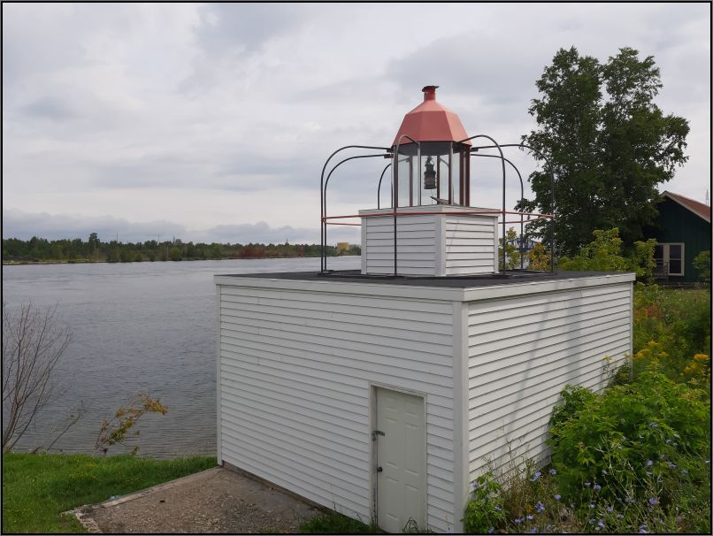
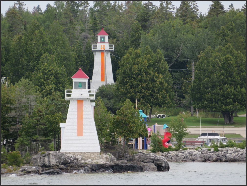
Our first stop was on Water Street, where the Little Current lighthouse is located. It was a great spot to observe how the bridge is swinging, as we’ve had a great timing to get there.
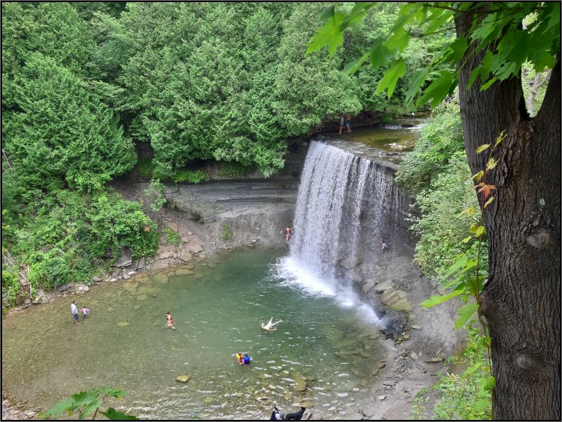
Kagawong was our next stop. In the Ojibwe language, Kagawong means “where mists rise from the falling waters,” a befitting name as the eleven-metre-tall Bridal Veil Waterfalls are situated a short distance from where Kagawong River meets Lake Huron. For the ones who want to take a splash, the access to the river and falls is about 800 m downstream, where the Old Mill Heritage Museum is located, also a big parking lot for those who want to hike the few trails in the neighbourhood.
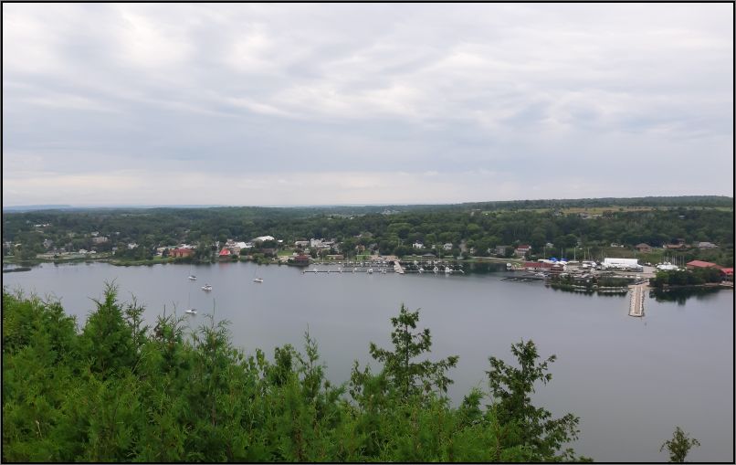
Gore Bay is only minutes away from Kagawong. A small town providing safe harbour to the boats is somehow cramped at the south of the bay.
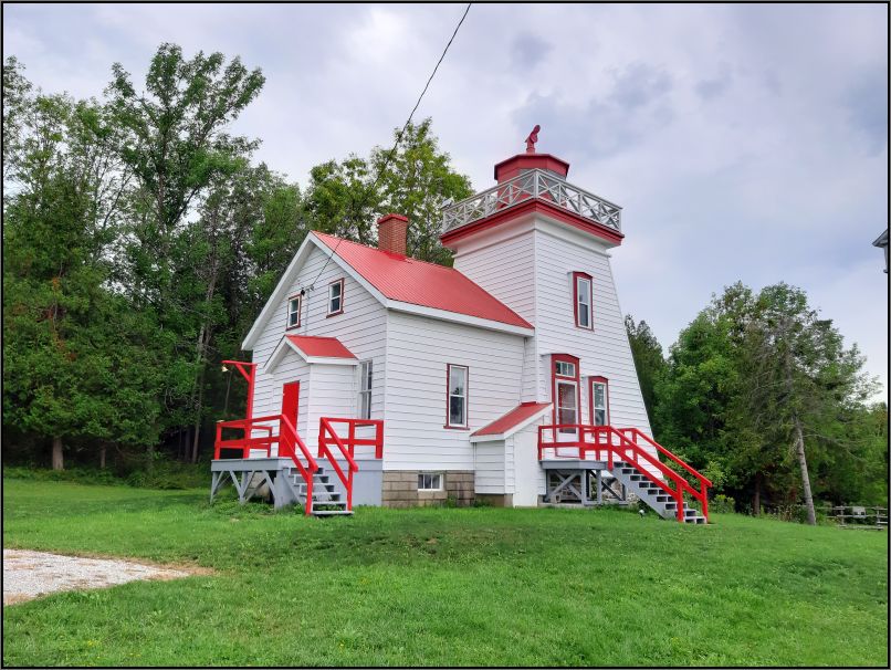
The Janet Head lighthouse has been a private summer home for the Fletcher family since 1967, as they took out a lease on the property. Four generations of Fletchers have cared for this property, until 2016, when it was closed due to safety concerns. The site was re-opened in 2019 after renovations, and opened 3 days per week in July and August for visitors. Unfortunately, the lighthouse was closed this summer due to Codiv-19 closures. The Coast Guard continues to maintain the light, which is currently an occulting, solar-powered L.E.D. light that runs 24 hours a day, 7 days a week, flashing three seconds on and two seconds off.
The next lighthouse on our route was Mississagi Strait Lighthouse, located at the Western point of the island. A bit of a driving through pristine lands might get you distracted, while you are admiring the surroundings. Make sure you keep your attention on the road, as a deer might jump in front of your car at any time.
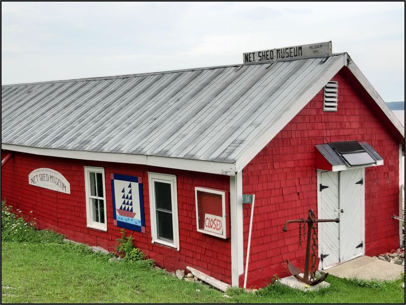
After stretching a little bit, and taking a picture of Ned Shed Museum (which was also closed) in Meldrum Bay,
we looked for a street heading to the western end of the island. It wasn’t hard to find the Lighthouse Rd, and we ignored the little hand-made sign which said the Lighthouse is closed, as we didn’t expect to visit the lighthouse inside. We knew is going to be closed. But after 8 kms on a rough country road, we found ourselves in front of a few fences, and two big signs of ‘Private Property’, one of which is of a LaFarge quarry. Sadly, we had to return, very disappointed we had to drive quite a bit to find locked gates.
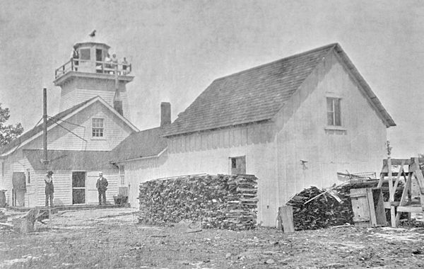
As per LighthouseFriends website, Mississagi Strait Lighthouse, erected in 1873, consists of a square tower surmounted by a lantern room and attached to one corner of a one-and-half-storey keeper’s dwelling. The tower stands 28 feet tall from its base, but the light has a focal plane of 46 feet above the straits thanks to the rocky bluffs on which the lighthouse was built. A beautiful description, for sure we missed a wonderful site.
Our next stop was Providence Bay, where we had our overnight reservation. Located on the south shore of Manitoulin, and looking out upon Lake Huron, Providence Bay is the perfect place for a stop over, to enjoy the best sand at the beach, take a swim in the clear turquoise water, or watch an amazing sunset at later hours. But we were not here to go for a swim, but to search for a lost lighthouse.
We couldn’t see any lighthouse sign on the map we’ve had from the Visitor Centre, but I’ve read online about a lighthouse in this bay, however. Driving to the end of the Hwy 551, we expected to see another road towards the southern end of the bay, accordingly with Google map. But we found some private properties and dead ends instead. With an adventurous spirit, my daughter and husband agreed to proceed on the big boulders along the lakeshore instead. An overcast sky let us the impression the sun has set already, as in all our excitement we forgot to check the time. Jumping from boulder to boulder we continued our way, the amazing clear water mesmerizing us all the time.
The original Providence Bay Lighthouse built in 1904 had a fixed white light elevated 43 feet above the lake level, and visible 18 km from afar. It was automated in 1953, but twenty years later, on October 14, 1973 the old wooden lighthouse burned to the ground.

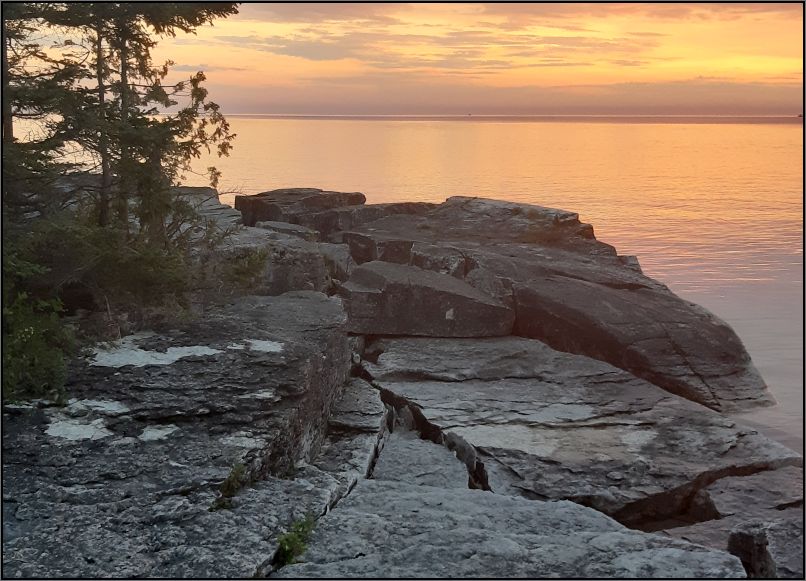
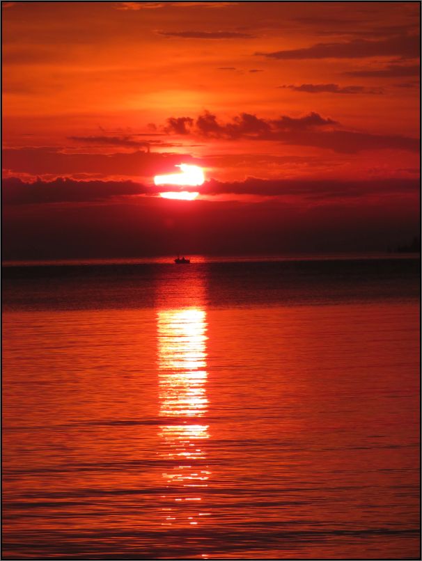
As the sun has suddenly got underneath the clouds, I was very happy to find we still have some light for our way back, as I wouldn’t want to jump over the rocks and boulders if it’s getting too dark. But the surprise we’ve got was at the time when the sun decided to go setting, hiding behind the clouds and the horizon.
Missing the Michael’s Bay lighthouse, I will tell you a bit about the other three lighthouses from Manitoulin Island we’ve seen along our 2017 Road trip, when we’ve been Around Huron Lake in 8 days.
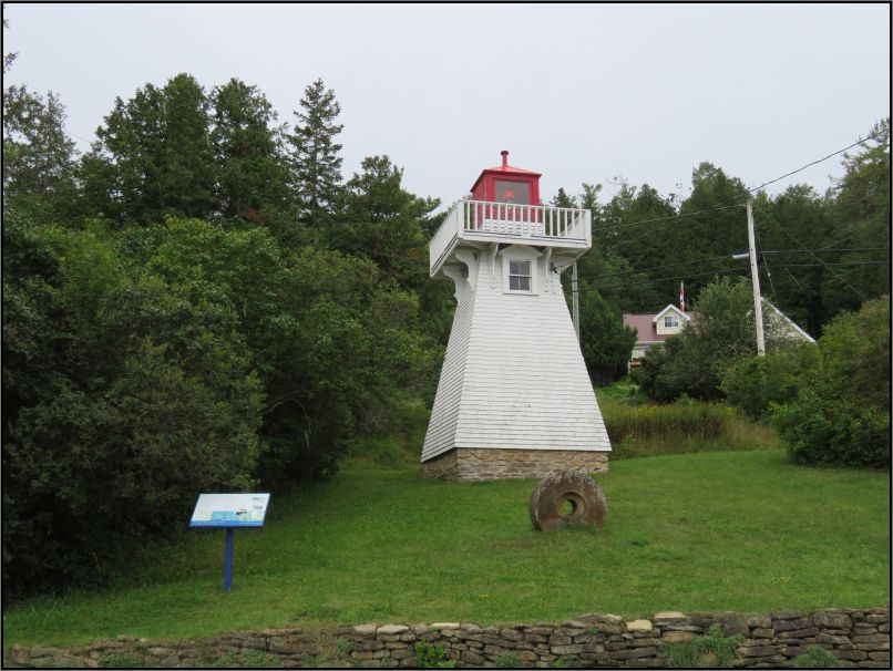
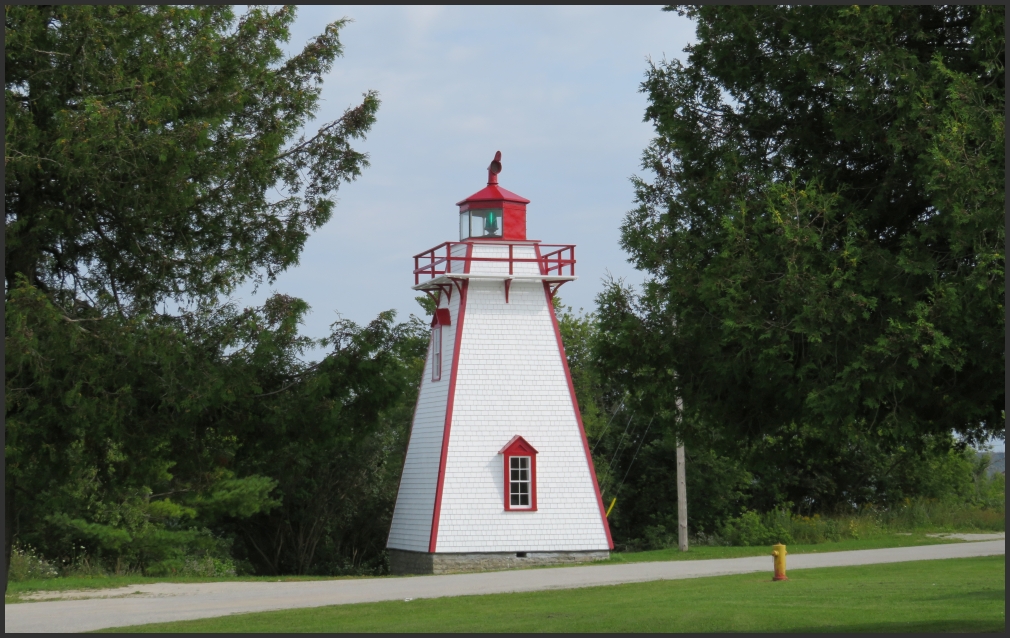
Although Manitowaning was selected in 1837 as the site for the first European settlement on Manitoulin Island, Manitowaning lighthouse was completed only in 1885, consisting of a square, wooden pyramidal tower, standing 34 feet tall from its base, with a hexagonal lantern room. With the help of the hill atop which the lighthouse stands, the focal plane is actually 80 feet above the Manitowaning Bay. In 1951 the white light has been changed to green light to distinguish the town lights, and in 1960 the tower was automated.
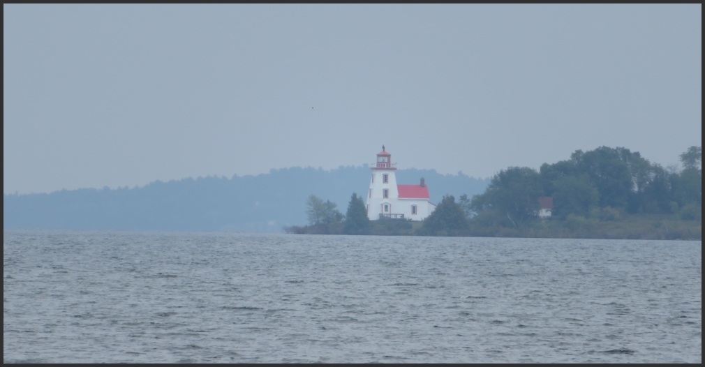
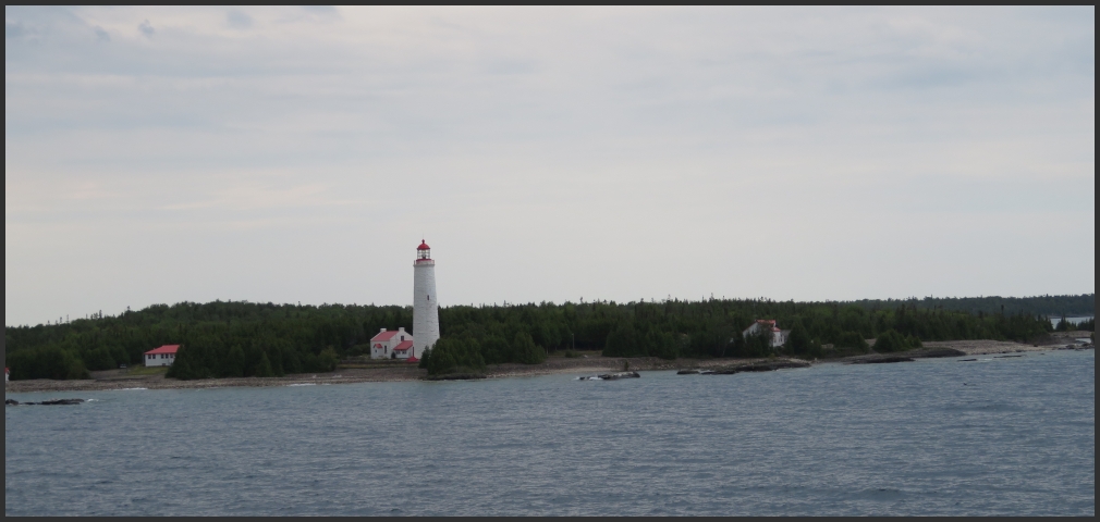
A nice addition to the list is the Cove Island Lighthouse. Although this is a lighthouse you can see only from the ferry (as the island is located about 8 km away from Tobermory), I thought it would be nice to have here.
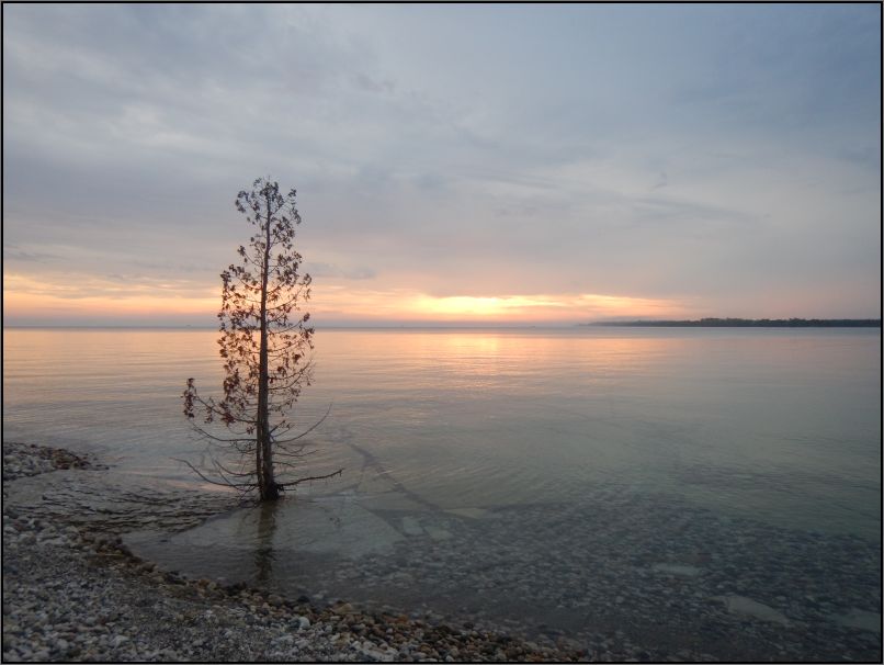
I will end the post with one of the most amazing sunset we witnessed, while we were returning from our lighthouse search.
Tip(s) of the day:
- Make sure you’re getting a map from the Tourism Centre in Little Current, as you can get a lot of useful information;
- Get your camera ready, as you can see some wildlife along the road;
- Although the roads might look empty, ensure you drive carefully, as some wildlife might jump in front of your car;
- Don’t forget your fishing rod if you would like to fish in one of the bays, or lakes throughout the island;
- Sturdy footwear is recommended if you are going hiking, or searching for new adventures;
- Providence Bay offers an amazing beach, with a big playgroud, take your time to sun bath, or go for a swim!
~ visited in August 2020

This looks like a fabulous place for a visit. Thanks for sharing Christie. Allan
LikeLiked by 1 person
Manitoulin Island has its own magic for sure, so much to see on the island and the surroundings. A wonderful retreat, about 6 hrs from Toronto. Thank you for reading!
LikeLiked by 1 person
Quite a tour of lighthouses, Christie. That lone tree was special as well. Thanks. –Curt
LikeLiked by 1 person
Quite a long post I know, but I didn’t really want to break the tour. Thank you for reading!
LikeLike
I’ve always loved light houses, Christie.. Coastal Oregon has some beauties. And I remember one on PEI that really charmed me. –Curt
LikeLiked by 1 person
It’s a pity that access to the Mississagi lighthouse was closed. I had been there on my long weekend on the island and I liked the old look of the lighthouse with the keeper’s dwelling attached. It was in good condition, it should reopen one day.
LikeLiked by 1 person
Lucky you!! I will probably go back someday to see Mississagi lighthouse too! Have a great week!
LikeLiked by 1 person
I’ve never been to Manitoulin Island island before, but I’m planning on going there this summer. It looks like it has so much character and I love all the lighthouses. Awesome picture of the sunset!
LikeLiked by 1 person
That’s a great destination, it will not disappoint! Providence Bay is a great place to stay, and it offers great opportunities for amazing sunsets🙂 Thank you for stopping by!
LikeLiked by 1 person
I absolutely love lighthouses! Always wanted to live in one…
The ones in Australia have all been automated, which is quite sad as the history when families or solo-people lived there is fascinating.
Great post and photos! The island looks so beautiful.
LikeLiked by 1 person
It is nice to see they have maintained the historical houses (where possible) even though the lights were automated. I love them too😊
Thank you! xx
LikeLiked by 1 person
I’ve never heard of this island. Fascinating history and great photos of all the lighthouses
LikeLiked by 1 person
About 6 hours north from Toronto, the island is a great retreat. There is a lot to see and to learn, as a part of the island, Wikwemikong, is the only unceded Indian Reserve in Canada. As for the lighthouses, this is a little paradise for lighthouse lovers. Thank you for stopping by😊
LikeLike
It’s good to know where these places are 🙂
LikeLiked by 1 person
Great post! I was there in October 2020. It was raining so we didn’t have a good visit!
LikeLiked by 1 person
Oh no, so unfortunate you got rainy weather on your visit there. You should go back one day in the summer🙂
LikeLiked by 1 person
I hope so!
LikeLiked by 1 person
I love exploring lighthouses. Love the blog and your YouTube channel.
LikeLiked by 1 person
Aren’t they cute? I love them too😍 Thank you for following and for your kind comment.
LikeLike
You are welcome
LikeLiked by 1 person